Thursday, July 11, 2013

Rocky Mountain National Park Days 6 and 7: Colorado River Trail and the West side of RMNP

After five days of serious hiking in the mountains, we checked out of our campsite at Moraine Park and headed for Estes Park.  It was our 8th anniversary, and we decided to celebrate in style.  We've had a bit of a tradition of celebrating our anniversaries in picturesque locales.  From Mackinaw Island in Michigan, to Sherburne Pass in the Green Mountains of Vermont and Glacier National Park in Montana, we've been lucky enough to celebrate in some stunning landscapes.  

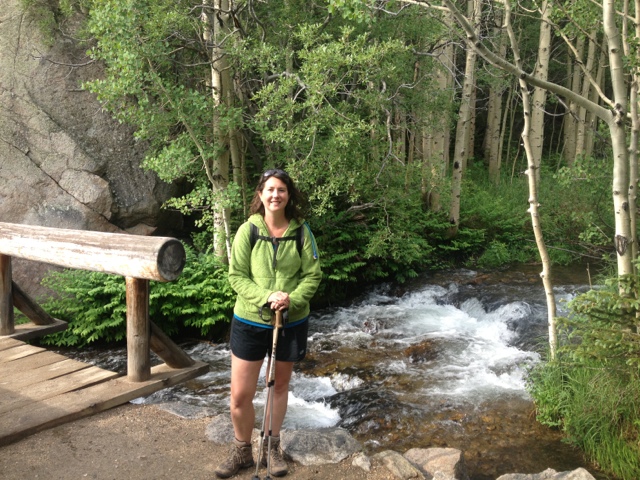
Before heading into Estes Park, we took one more hike in the park, our last on the East side of the continental divide.  We selected the trail to Cub Lake as an easy day hike.  It was a chance to stretch our legs while letting our muscles rest and recover from recent harder climbs.  

The Cub Lake trail is a very popular route that meanders along the edge of beautiful meadows and verdant wetlands for 2.3 miles.  The last half-mile of the trail climbs close to 500 feet in a hurry to the shores of the pretty little lake.  Cub Lake is a small lake, its surface nearly covered in lily pads.  The Fern Lake fire of 2012 did extensive damage to the surrounding trees and hillsides.  I think this was probably a more picturesque lake prior to the forest fire.  

The hike was a nice change of pace for us.  We took our time, surveying the adjacent wetlands for moose while we walked.  The largest member of the deer family would not make an appearance for  us on this hike, though.  We were lucky enough to spot several  hummingbirds along the way.  

After a brief lunch stop at Cub Lake, we returned to the trailhead via the same route we had taken out.  We were looking forward to the comforts of town for a night.  We stopped at a laundromat and did some much needed laundry on our way to the hotel. 

We found a room at the Discovery Lodge, a short walk from the downtown business district.  Our room was decorated in "log cabin" style furniture and wall hangings.  From the outside hot tub we had a view of the front range of the Rocky Mountains.  It was the perfect place to relax for a night.  

For dinner, we stopped at Momma Rosa's in downtown Estes Park.  They served delicious homemade italian entrees in a charmingly non-pretentious atmosphere.  The patio seating afforded views of the Big Thompson River.  While we were eating dinner, a storyteller was presenting some of the history of the area on the river walk next to us.  A public sing along was held in the city park earlier in the evening.  Everything about Estes Park screamed "charming, mountain town."

We hung around the hotel in the morning, soaking up every bit of modern convenience until check-out time.  We grabbed breakfast at The Egg and I, which has quickly become one of my favorite breakfast joints.  Caffeinated and fed, we were ready to make the drive over the continental divide to the west side of the park.

The Fall River Road is a one-way, dirt path that climbs above 11,000 feet to the Alpine Visitor Center.  The drive had some white-knuckle moments.  The road switchbacked up steep slopes with exposed drop-offs mere feet from our tires.  The drive took us through a enchanted forest of fragrant pines and by babbling mountain streams.  

The 11 mile drive took us over an hour.  It was too beautiful to hurry through this stunning landscape.  At the Alpine Visitor Center, the road intersected with Trail Ridge Road, the modern replacement for the dirt road, and the highest, maintained, paved roadway in the world.  

We stopped in the visitor center and listened to a presentation on the animals of the alpine tundra, before beginning the drive down to Grand Lake.  Heading west, the road was paved and much less scary to drive.   In another hour, we were in Grand Lake.

Grand Lake was much smaller and less fancy than Estes Park.  The town had a western feel to it.  Three massive, interconnected lakes dominated the valley around Grand Lake.  We drove to our campsite for the next three nights, the Green Ridge Campground.  Located right on the shore of Lake Granby, this Arapaho Forest Service campground was mostly empty when we checked in. 

The surrounding lakes appeared to offer a very different ecosystem than the mountains.  We spotted several ospreys near the lake, including a couple that were nesting on telephone poles.  While we were setting up camp we watched an osprey fly away from the lake with a big fish in its talons!  Lake Granby was also home to a large flock of Wood Storks.  These giant, white birds looked startlingly out of place in the mountains.  Watching their graceful flight over the lake was a special treat for us.  We also spotted a beaver, cruising around the river mouth of the North Fork of the Colorado River.  

It was a quiet night of camping in the mostly empty Green Ridge Campground.  In the morning we headed out for our first hike on the west side of the continental divide.  We decided to take it easy, with our backpacking trip just a couple of days away, so we selected the Colorado River Trail.  A 3.7 mile hike on this trail took us through tall pine trees and open marshy areas beneath the towering mass of the Never Summer Mountains to Lulu City.  

Lulu City was the site of a mining town in the 19th century.  Once home to 200 hardy pioneers, the city is now a ghost town, with no signs of human activity.  Hiking next to the Colorado River here was fascinating to me.  The impressive force of nature responsible for the canyons of Utah and Arizona that we had hiked near earlier in our trip was a gentle mountain stream as it wound its way out of the Rockies.  

  We ate our lunch on the shores of  the quiet stream.  Harmless, puffy, white clouds drifted by overhead.  The mountain weather, so often full of unpredictable fury, was delightfully mild on this mid-summer day.  On our hike back to the Jeep we spotted several piles of moose scat along the trail.  We scanned the wetlands areas we passed carefully for moose while hiking, but to no avail. 

While driving back to the campground, we noticed a large crowd of people gathered on the edge of the road.  Mary pulled the Jeep over while I rolled down the window to ask what they were looking at.  "Moose!" one of the men said in a hushed town.  Mary quickly found a parking spot, and we pulled out the binoculars.  A cow moose and a calf were quietly eating willlow leaves in a small marshy area near the road.  The crowd snapped photos and whispered to one another in wonderment.  The cow had dark black fur, with a fine silvery gloss to it.  The calf was a lighter shade of brown.  Its long ears flopped around trying to ward off bugs. 

No sooner had we gotten back on the road, when we noticed another roadside gathering.  We were delighted to find this crowd had spotted a bull moose.  Its antlers looked soft and fuzzy.  Truly a gentle giant, the bull moose was eating his way through a thicket less than 30 feet from the road.  I couldn't help but marvel at the luck of spotting three moose within a few minutes of driving.  We had once taken a 70 mile, three-hour drive around northern Vermont looking for moose, with no success!  I guess today was make-up for previous efforts.  

The west side of Rocky Mountain National Park appears to have a lot less people, and more wildlife than the east.  We're looking forward to exploring this new terrain more in the days to follow.


Wednesday, July 10, 2013

Rocky Mountain National Park Day 5: Twin Sisters Peaks

Having logged almost thirty miles and almost six thousand feet of elevation gain in the park, we decided we were ready to attempt our first summit hike.  Making a summit of a mountain in Colorado requires a certain amount of caution and planning.  Most of the peaks are well above tree-line.  The frequent afternoon thunderstorms mean that hikers must make sure they are back beneath that line before the daily storms arrive.  

With this in mind, we set the alarm for 5:30 am.  The gusty winds from the night before had passed, and it was still in the campground at this early hour.  A few songbirds darted about while we hurriedly at breakfast and loaded our day packs.  Our destination was the Twin Sisters Peaks.  This summit, about ten miles outside of Rocky Mountain National Park, can be reached via a tough, 4 mile, 2,300 foot climb.  It would be our first foray above 11,000 feet of elevation in our lives.

We were on the trail before 8 AM, under the cover of brilliant blue skies and abundant sunshine.  Judging by the number of cars already at the trailhead, this was a popular hike.  The trail wasted no time in beginning its abrupt climb through a dense pine tree forest.  The first stretch of trail ascended east, directly into the blinding rays of the morning sun. The intense light cast picturesque shadows through the neat stands of tall, skinny pine trees.  

The hike followed a seemingly endless procession of switchbacks.  The pitch was severe enough that we were both breathing heavily throughout the hike.  As we climbed, views of Long's Peak occasionally shown through gaps in the forest.  It was easy to imagine that the view at the top would be tremendous.  

About thirty minutes into our hike, we passed a large group of teenagers headed in the opposite direction.  They were part of a youth group or summer camp that had hiked up at 3:30 am in order to watch the sunrise from the summit.  I marveled at the exuberance of teenagers as we huffed and puffed our way uphill.

About 1,500 feet into our climb, the trail passed through a stunted forest of tiny pine trees.  The cold, thin air at this elevation made it difficult for trees to grow to their usual heights.  A few switchbacks later, the trees dropped away entirely.  For the first time on our trip, we were above tree-line.

The terrain above the forest was a stark, dramatic one.  A maze of boulders, rocks, and slabs of granite littered the mountainsides all the way to the summit. Tiny, fragile looking wildflowers peaked through the dry rock in places.  The views, no longer obstructed by trees, were astounding.  Snow-capped peaks stretched to the horizon, and the city of Estes Park looked like a model.  

The further we climbed, the tougher the hiking got.  This was likely a combination of the jumbled mess of rocks we were climbing over, and the thin air above 11,000 feet.  Gradually, the communications tower at the top came into view.  Beyond the tower, the trail climbed to a false summit with amazing views of Long's Peak, a 14,000 foot mountain to the west.

We stopped here for a much needed rest and some snacks.  The true summit of Twin Sisters Peaks was off-trail.  A short scramble up a mass of boulders and rocks was required to reach the actual highest point, one most hikers never visit.  

Mary was tired and ready for a rest, but I thought I had some energy left.  The skies looked friendly, still, so I thought I would go for it.  The walk to the base of the climb was arguably the toughest part.  With no trail to follow, I had to pick my way through boulders and slabs of rock.  It made for precarious walking.  Eventually, I reached the base of the climb.  From here I simply picked the path that looked the least resistant.  The scramble up took less than five minutes, but it did require me to use my hands to pull myself up and over boulders and ledges.

At the top I found the survey marker stamped into the surface of the rock by the Bureau of Land Management that indicated the true summit.  The winds threatened to knock me over as I took a few photos.  Mary took my picture from the communications tower, which I've included below.

The climb back down was a slow one, but within ten minutes I was back at the trail.  Nervous about getting caught in an afternoon thunderstorm, we began our descent in earnest.  We passed hordes of hikers heading up the trail while we hiked.  I couldn't help but wonder how they would fare in a thunderstorm.  

The hike down was brutal on our knees.  The resistance muscles needed for downhill hiking just don't get as much use as other muscle groups.  We were more than ready to be done by the time we walked through the final set of switchbacks.  Right on schedule, the loud crash of thunder echoed over the mountain.  Rain began to fall as we hopped into the Jeep.  We felt vindicated in getting up so early to hike.  Our first summit experience was an exhausting one, but a gorgeous hike.  


Monday, July 8, 2013

Rocky Mountain National Park Day 3: Bear Lake to the Loch

Despite going to bed with clear, starry skies, were were awoken by thunder and lightning a few hours later.  A deluge of rain lasted for several hours during the night.  Happily, our tent faired well in the storm, and we were dry and warm throughout the night.

Morning came with dry but cold weather, and scattered clouds clinging to the mountain tops.  After our first couple of experiences with afternoon thunderstorms in the Rocky Mountains, we decided to get up early.  We had a quick breakfast of cereal and coffee and then headed for the Bear Lake Trailhead.  This launching point for a wide number of hikes is located at the end of Bear Lake Road, a road that has been under construction for a couple of seasons.  The park requires hikers to either drive into the the area before 9 AM or take the shuttle bus from a parking area.  We were early enough to be allowed to drive into the park, saving us time.  

The parking area at Bear Lake fills up quickly.  We were one of the lucky last few to get spots before park rangers started turning people away.  The trailhead area was packed with everyone from families with screaming children in tow to mountain climbers with heavy packs of rope and other gear.  We made our way through the sea of people and were soon on the trail.

The first half-mile of hiking followed a wide dirt path that made a very gradual descent through a lush green forest.  The previous night's loud thunderstorm seemed to have favored the  vibrant green vegetation.  The roar of Glacier Creek could be heard through the trees to the East of us.  The morning air was cool and pleasant for hiking and the skies unthreatening.

The trail arrived at a junction with the Glacier Gorge parking area.  The climbing began in earnest after this.  Our hike would only climb about 1,000 feet, but it would do it in less than 3 miles, making for a fairly steady ascent.  The trail remained an easy, level surface to walk on, however.  

A short while later we passed Alberta Falls.  Swollen by heavy rain, the falls were an absolute whitewater show.  The thunder of pounding water drowned out conversation along the trail.  We stopped to take pictures and marvel at the tremendous power of water.

Beyond the falls, the trail climbed across an open ridge.  The lack of trees in this section allowed us views of the snow-capped mountains above.  The skies were a dull gray, and gusts of cold wind whipped across the open ridge.  Hiking in the morning had saved us from the threat of afternoon thunderstorms, but the trade off was chilly mountain air.  

As we climbed, Glacier Falls came into view.  These falls put on an even more spectacular display.  Glacier Creek dropped hundreds of feet over the course of less than a mile in an astounding torrent of violent water.  Downed trees, ripped free from the mountainside by the power of water, littered the creek's path.

The remaining section of the trail to Loch Vale was a steady ascent up a series of switchbacks.  We huffed and puffed our way along the trail, the air growing colder as we hiked.  This hike was our first trip above 10,000 feet of elevation.  A large mass of frozen snow greeted us at the top of the final switchback, the first snow we had seen since April in Michigan.

The Loch was truly stunning.  A crystal, clear lake lined with low rock formations and hardy pine trees, it was reminiscent of many of the lakes in Northern Ontario.  The one key difference, however, being the 3,000 foot rock walls towering over the lake.  Snow-capped mountain peaks dominated the skyline, the steep mountain walls adorned by Andrew's Glacier.

By climbing over and around the large rocks that bordered the lake we were able to see the picturesque alpine lake from a variety of viewpoints.  Peering through some small pine trees off to the side of the lake we could see a beautiful alpine meadow with a small stream flowing through it.  The entire landscape was almost too stunning to believe.  

The air by the Loch was freezing cold, and a chilling breeze blew across the water, pushing small waves towards the shore.  We pulled on our fleeces and ate a quick snack while sitting on the shore.

Our return hike was met with gradually warmer weather and dozens of hikers who had made a later start to their hike.  By the time we returned to Alberta Falls, the sun was shining brightly overhead and dozens, if not hundreds, of tourists were climbing the rocks by the falls.  We made our way back to the trailhead, wading through the crowds of families like salmon swimming upstream.  

The hike concluded at the trailhead a few minutes after noon.  We were happy to have the rest of the day free to relax and enjoy the beautiful mountain scenery.  We ate a big breakfast for lunch at The Egg and I in Estes Park.  In the evening we attended a ranger presentation on black bears in the park, before falling asleep beneath a canopy of stars.  We have been having an amazing time in Rocky Mountain National Park.  


Sunday, July 7, 2013

Rocky Mountain National Park Day 4: Ypsilon Lake

The night brought another surprise thunderstorm while we were asleep in the tent.  Brilliant lightning lit up the night sky, and heavy rain and gusty winds blew through the campground for hours.  It was further proof of the volatility of mountain weather.  Despite going to bed under starry skies, we climbed out of the tent to find standing water all over the campground.  Our REI tent performed extraordinarily well and we were completely dry again.

We fixed skillets for breakfast and took the time to enjoy an extra cup of coffee before heading out to hike.  Our destination for the day was the trail from the Lawn Lake Trailhead to Ypsilon Lake.  This would be our hardest hike in the park thus far.  The trip up to the mountain lake was 9 miles round-trip, and the trail climbed nearly 2,200 feet.  

We set off under sunny skies with pleasant, cool weather.  The trail wasted no time climbing.  A tightly woven series of switchbacks climbed a couple hundred feet above the valley below.  A large meadow was visible to the south, and several snow-capped mountains loomed in the distance.  

The switchbacks eventually ended and the trail paralleled the Roaring River for a few minutes.  The hiking continued to be uphill, but more gradual along the side of the stream.  This area was the site of a massive and violent flood that swept down the mountainside years ago.  A violent scar remains to this day.  The swath of rocks and mud rose twenty feet on either side of the river, reaching all the way to the valley floor.  

Eventually, we reached the intersection with the trail to Lawn Lake.  Our trail took us across the river on a log bridge.  The rising mass of Ypsilon Mountain was visible by looking up the stream path.  Fishermen tossed flies into the raging currents in a scene that resembled the cover of a Field and Stream Magazine.

The majestic views quickly came to an end, and the trail began a relentless climb through a dense pine forest.  For the next hour and a half we lumbered up hill, breathing heavily as we hiked.  The lack of views added to the treadmill feeling of the hike.  Gradually we began to glimpse a gap in the forest ahead, framed by snow-capped mountains.  

Just when it seemed we could climb no longer, the trail dropped gradually to the shores of small pond.  Beyond the pond, the path climbed through a boulder field before beginning a steep descent to the edge of the lake.  Predictably, the omnious rumble of thunder greeted us to the shores of Ypsilon Lake.  The reliability of the afternoon thunderstorms were truly remarkable.  You could almost set your watch by them.

We picked our way along the shores of the lake, searching for a suitable spot to stop for lunch.  Black clouds passed overhead, seeming to scrape their bottoms on the steep summit of Ypsilon Mountain.  Cold, heavy raindrops began to fall.  It was little more than a light shower at first, but the skies promised more.

We found a spot on a log under a mature pine tree and sat down for lunch.  No sooner had we pulled out our sandwiches than the heavens opened up.   Our spot under the pine tree was remarkably protected.  We stayed mostly dry, eating our lunch while watching the once calm surface of the lake turn into a sea of ripples under the deluge of rain.

Like with most of the storms we have seen here, the weather passed quickly, and soon the  skies  were dry and the threat of severe weather ended.  We watched the lake while hundreds of fish began to jump to the surface, sending small splashes across the water.  Ypsilon Lake was a big lake.  Dense pine trees made it difficult to see into all of the corners.  The mountainsides rising beyond it looked lonely and desolate.  Scars from avalanches and rock slides marred the steep slopes.  

The brief rain storm brought out the first significant batch of mosquitos of our trip. The unwelcome additions to the forest sent us eagerly away from the lake and back down the trail.  By the time we were crossing the Roaring River again, the sun was shining brightly amid puffy white clouds.  

The downhill hiking went faster than the climb had gone, and in no time we were back at the Jeep.  Climbing Mt. Ypsilon had turned out to be quite a work out.  The scenery at the lake was beautiful, but I'm not sure it was worth the 9 miles and 2,000 plus foot elevation gain.

In the evening, we attended another ranger presentation in the Moraine Park Amphitheater.  This program was about unusual animal sightings in Rocky Mountain.  Since the park was designated a wilderness in 2009, a variety of wild animals not usually found in Rocky Mountain have been documented.  Wolves, long since extinct in Colorado, have been making appearances, likely coming down from Idaho and Wyoming.  The park isn't yet sure if a breeding population has been established.  While ranchers would certainly not welcome the return of wolves to Colorado, the park ranger sounded as if the national park system would be eager to see them return to the terrain they once roamed.  

Another hikers spotted a wolverine west of the continental divide.  Wolverines had not been seen in the park before,, but the alpine environment is perfect for them.  Lynx have been reintroduced to Colorado, and the park is on the lookout for the felines.  The only missing animal from what this terrain once was is the grizzly bear.  Maybe they will find their way south to the mountainsides as well one day!

The ranger told a great story about a wedding party in the park a few years ago.  A group decided to get married in the park in the fall.  They posed for the traditional wedding photos in a clearing in front of the forest.  A few days later, when the photos came back, they were shocked to discover a mountain lion standing on the cliff above them, watching the proceedings!  There is something captivating about the wild animals here in the mountains.  With stories of woodland creatures in our heads, we crawled into the tent and got ready to weather another night of turbulent weather.


Saturday, July 6, 2013

Rocky Mountain National Park Day 2: Fern Lake

After what felt like the longest day ever, we decided to sleep in at our beautiful and hard-earned campsite.  It was the first morning we had been able to sleep in on in a few days, and the cool weather was ideal for sleeping.  After finally waking up, we fixed a big breakfast in camp while watching some Elk wander through the campground.  

It was one o'clock by the time we reached the trailhead for our day's hike.  The Fern Lake trail climbs over 1,400 feet into the interior of the park, past a couple of large waterfalls to an alpine lake.  

The sun was shining warmly as we headed off down the trail.  The first stretch of the trail was very well-maintained, as it followed the shores of a cascading mountain stream.  The path was wide and easy to follow, and we frequently passed hikers and fly-fishermen heading in both directions.  Steep rock walls rose above the trail in many places and knotted pines grew around and even through the scattered rock ledges and boulders.  Lush, marshy areas were visible alongside the stream, an excellent habitat for moose. 

About thirty minutes into our hike the trail snaked around some massive boulders, relics of the last ice age left behind by retreating glaciers.  The skies had been gradually growing darker as we hiked, a fact we had been able to ignore until the unmistakable sound of thunder echoed down the mountain.  The dark skies looked foreboding against the backdrop of snow and granite mountain tops above.  We briefly considered turning back.  Our hike was entirely below tree line, though, so we figured it was reasonably safe to proceed.  

A few minutes later, rain drops began to fall from the ominous clouds.  We stopped to pull out our rain jackets, peering up nervously at the skies.  The trail eventually arrived at an area called The Pool, a spot on the rushing stream where boulders and logs had blocked up the river just above a small waterfall.  A log bridge crossed the stream just below The Pool.  My hiking guide said that some people swim here, but it looked like a pretty bad idea to me.  The water appeared to be rushing towards the next drop pretty briskly.  

Just past The Pool and the backcountry campsite beyond it, the trail began to climb in earnest.  The forest was suddenly very silent, except for the patter of raindrops on our coats and the occasional crack of thunder high above us.  Thunder takes on a very different quality in the mountains.  The skies seem closer to the land, and the towering mountains catch the sound and send it echoing down in a hundred different directions.  Most of the lightning sounded to be far off, based on the old method of timing the delay before thunder.  One particular flash,  though,  caused us to both duck instinctively, as the crack of thunders sounded mere seconds later!  

The trail climbed consistently over switch backs through the ruins of last year's Fern Lake forest fire.  Dense stands of blackened pine trees adorned the hillsides.  Brilliant green grasses had begun to grow up through the torched landscape, evidence of the regenerative effects of fire.  

As we trudged uphill through the rain, we passed a family heading out on a backpacking trip.  The children looked to be less than ten years old.  I was impressed to see them carrying their own backpacks on the tiring climb.  Near the top of a switchback, the trail passed a thundering waterfall.  Whitewater crashed violently down the mountainside.  Massive downed trees  lined the edges of the stream, having been tossed aside by the terrifying power of falling water.  We stopped for a few photos at the falls before resuming our steady climb.

The trail continued to climb at a moderate pace as the sound of the raging stream fell away.  The thunder and lightning appeared to have stopped, and only a steady light rain was falling as we continued the climb to Fern Lake.  

Fern Lake was a fairly large lake, bordered by towering stands of tall pine trees and framed by steep rock walls on three sides.    A small cabin used by park rangers on the shores of the lake was the only evidence of human activity.  We found a dry spot to sit and eat our lunch under some pine trees.  The air had grown quite cold and the rain more intense, making for a short and chilly lunch stop.  No longer warmed by the exertion of climbing, we were both quickly chilled.  

We snapped a few photos of the lake and then started the return hike.  The family of backpackers passed us shortly, the father now carrying two of his kids' backpacks!  Within fifteen minutes, the rain stopped and the sun came out.  The rest of our hike was a pleasant walk through a beautiful pine forest aided by a cool mountain breeze.  The rapidly changing nature of the weather in the park was something to marvel at.  By the time we reached the trailhead, we were both hot enough to turn on the air conditioning in the Jeep.  The trail to Fern Lake was a beautiful hike, even through a mountain thunderstorm!  


Friday, July 5, 2013

Rocky Mountain National Park Day 1: Bridal Veil Falls

We were up early for the long drive to Estes Park and Rocky Mountain National Park.  The drive was a beautiful one, climbing over several mountain passes and through vast stands of pine trees.  We stopped for some coffee and a cinnamon roll in a quaint little town on the way.  Everyone seemed to be buzzing with holiday weekend energy, with the 4th of July fast approaching.  Every campground we drove by, and most boat launches and picnic areas were crowded.  We couldn't help but wonder how crowded a national park would be during the holiday weekend!  

We drove with the top off the Jeep for a while, until a light rain forced us to pull over and put the top back on.  It was the first rain we had seen in 24 days!  After being in the desert for so long, the cool air, clouds and even rain were welcome!

For lunch, we stopped at a small brewery in Boulder, the Southern Sun Brewery.  Boulder looked to be a really fun city, with many breweries, restaurants, and outdoor gear shops.  The brewery had a wide variety of craft brews and great food with some really good vegetarian options.  The strong craft brews were more than welcome after 3 weeks of Utah beers. 

By the time we drove into Estes Park, it was after 6 PM.  The road into the town provided a spectacular view of the "front range" of the Rocky Mountains.  Some of the peaks still had snow clinging to the rocky faces.  Approaching it from above, Estes Park seems to be in  bowl, ringed by massive mountains on three sides.  

We stopped at the grocery store in town for a few last minute supplies before looking for a campground.  While we were in the store, an intense thunderstorm rolled into the valley.  Sheets of heavy rain poured down, sending folks sprinting for their cars from the store.  It was our first mountain storm of the trip.

Not surprisingly, the national park campgrounds were all full for the night.  Disappointed, we drove around Estes Park looking for another place to pitch a tent.  We ended up at a Larimer County Park on St. Mary's Lake.  It was a small campground that had packed way too many campers in for the night.  We had been spoiled by beautiful national park campgrounds throughout our trip, and found the cramped conditions and sparse vegetation depressing.  We ate cheap pizza in the dark, hatching our plan for the morning. 

The alarm went off at 6 am.  We hurriedly packed up our campsite, ate the leftover cold pizza and headed for the Moraine Park Campground in RMNP.  The national park has been doing heavy construction in the park the past two seasons, and as a result, one full campground has been closed.  The Long's Peak campground, intended for climbers heading up the signature mountain, has a three-night limit. This left only the Moraine Park Campground on the East Side of the park, and within that campground, only one loop was available first-come, first-served.

Landing one of these sites can be be a real challenge, as campers have until noon to depart the campground, but could head out at any moment.  There is no waiting system, either.  It's simply a matter of whoever happens to be closest to a site when its vacated.  The whole scene has kind of a "black friday" vibe to it.

We circled the campground, likes sharks, eyeing each site that looked to be packing up.  We spotted a site that was empty, but had a tag on the post.  I jumped out of the Jeep to check the tag.  It was blank.  I had no idea what a blank tag meant.  I told Mary to drive up to the headquarters and ask if this site was available, while I made sure no one else grabbed it.  While she was doing this, a park employee came by, checking tags.  He looked at the blank tag and approached me.  "You need to fill this out!" he said emphatically.  I explained that it wasn't my tag, and asked if that meant the site was available.  He took the blank tag, and said it was fair game.  

As soon as Mary returned, we filled out our own tag, dropped the payment envelope in the box at the headquarters and set up our tent.  We figured possession was nine tenths of the law in this situation.  

No sooner had we finished setting up camp, when a woman with Missouri plates pulled up to our site and leapt out of the car, yelling accusations at us.  She seemed to think that we had poached her site while she was away.  I explained that the tag was blank, and no one had any way of knowing it was taken.  She drove off in a furry.  We both wondered if it would be safe to leave our campsite unattended for the next few hours.

Fortunately, the woman came back later and apologized for yelling at us.  She admitted that she had failed to fill out the tag, and even better, said that she found another campsite.  Our feelings of guilt assuaged, we could finally enjoy the campsite.  It was a beautiful site, with views of snow-capped mountains rising above it and plenty of privacy.  

Campsite issues resolved, we were eager to take a hike in such a beautiful landscape.  We headed for the Cow Creek Trailhead, north of town for our first hike.  The road to the trailhead was more picturesque than many hikes I have done. We followed a dirt road past expensive houses, and eventually some ranches, climbing high above Estes Park.  When we arrived, the trailhead was crowded with parked cars.  Ours was the only car without Colorado plates, always a good sign!

The hike crossed the waters of Cow Creek on a sturdy bridge, before passing a number of cabins and other structures used by the park service for visiting researchers.  Beyond this small village, the path passed through open meadows, ringed by rocky outcrops on three sides.  The meadows were teeming with beautiful wildflowers, and a scattering of aspen and pine trees provided occasional shade.  

The trail climbed gradually for the first couple of miles, and we passed many hikers along the way.  Everyone seemed to be in great spirits for the holiday weekend.  A couple of families we passed were lugging backpacks up the trail, heading out for an over-night trip.  One group had forgone the backpacks, and were just carrying armfuls of camping equipment as they hiked.

The last mile or so of the trail was much harder.  In several places, the trail climbed large, inclined rocks.  I had to use my hands in many places to avoid slipping and falling.  Stone steps placed by trail crews made the climbing easier in other spots.  The further we climbed, the more the rock walls closed in around us on both sides.  The open meadows at the beginning of our hike were replaced with a steep canyon that blocked out the sun.

The falls themselves were well-worth the tricky climb.  Bridal Veil Falls is the tallest drop in the park, at twenty feet.  In reality, however, the falls were much bigger than this.  Water slid across a rock slide both above and below the free-fall portion of the drop.  In all, water looked to fall at least a hundred feet over the course of less than a quarter mile.  

We rock-hopped across the base of the falls, enjoying the thick mist that soaked our clothes.  The skies overhead had grown dark, and a cold wind was now blowing down from the mountains above.  Was it raining?  It was hard to tell if we were just feeling the spray from the falls, or if it had started to rain.  The crashing water was loud enough to drown out any thunder.  

Safely on the other side of the falls, we stared a difficult scramble along a dirt path that climbed alongside the waterfall. It was slow going, but after about 100 feet of climbing, we were rewarded with a stunning view, looking down on the falls and into the steep canyon we had just hiked up.  We started to pull out our lunches, but the unmistakable crack of thunder interrupted the tranquil scene.  We were nervous about making the tricky down climb on wet rock, so we descended back to the base of the falls.  

The weather appeared to hold for a while, so we ate our lunch below the falls.  Patches of sun shown through the dark clouds.  After eating, we packed up and began the hike out.  We picked our way carefully down the steep, rocky sections of the hike.  We were grateful to have dry rock underfoot for this harder section of hiking.

The rest of the hike back to the trailhead was an easy stroll.  The storm that had held off for so long finally arrived while we were hiking, but it was brief.  By the time we returned to the Jeep, the sun was shining brightly and the air felt cool and dry. Our first hike in Rocky Mountain was a great introduction to the finicky mountain weather that is common here. 

We returned to our campsite to make dinner, nervously watching the procession of dark clouds that seemed to drift in from the mountains above us.  The skies threatened throughout the evening, but it would stay dry for the rest of the holiday.  

After eating, we drove into town and found a spot to watch the fireworks show.  The night air was cool, and the weather held off while we relaxed on the city golf course, watching the explosions over Estes Lake.  It was funny to think that last year we had gone to watch fireworks from a city park in Manchester Center, Vermont, during our Long Trail Hike.  From watching fireworks in the Green Mountains to the Rocky Mountains, we certainly have been fortunate to see so many cool places in the past year!