After leaving Burlington we elected to drive around Vermont and visit some of the interesting places we had driven past while shuttling vehicles between North Troy and Williamstown. One such place was the Quechee Gorge, in the mid-east part of the state. The Quechee Gorge is a rock canyon about 100 feet deep. The Ottauquechee River flows at the bottom of this gorge and has been slowly carving an ever deeper path through the canyon for thousands of years. US 4 passes over the gorge on an impressive bridge that provides a birds-eye view of the river below. Traffic tends to slow down drammatically as people drive across and gawk at the sudden, and often unexpected view. Just east of the bridge is a state park with pleasant camp sites set in a stand of very tall pine trees.
We decided to camp for two nights at the state park so we could explore the surrounding area and attractions. Being a weekend, the park was packed with families camping. Luckily, we were able to get one of the few sights still available. The heat wave that had been plaguing most of the nation had finally found its way to Vermont and temperatures were in the 90's for several days.
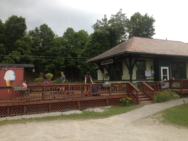
After setting up our camp sight we drove to nearby Bridgewater Corners and the home of Long Trail Brewing for a tour and some tasting. Long Trail Brewing is a neat company. All of their products are themed around the Long Trail, and the brewery is located just a few miles from where the trail crosses US 4. We sampled some of their products, and then purchased some to take home with us. Long Trail is only distributed in the East, meaning this would be our only chance to buy it for a while. Their feature brew is Long Trail Ale, a very drinkable beer. They also had a number of pale ales and IPA's on draft for the summer. This was one of the more interesting breweries I have been to thus far.
Next we drove back to the campsite, changed into our swim wear and took the self-guided interpretive trail to the base of the gorge, looking to cool off. Just below the last set of rapids the river mellowed out, forming several large pools suitable for swimming. Reaching the river required carefully climbing over some unusual rock formations formed by the river at higher levels. The hillside above the rock walls was littered with evidence of Hurricane Irene. I could imagine this gorge would have been an amazing, and terrifying place to be during last year's storm. We swam in the cool waters and enjoyed being out of the heat for a while. The canyon's steep walls blocked the sun most of the day, so the water was surprisingly cold and refreshing.
That night we fried up some veggie burgers that we had purchased at the whole foods store in Burlington on our backcountry stove while listening to the Tigers game on my IPhone. Not a bad way to spend a beautiful summer night. The skies were clear, meaning we were able to leave the rain fly off our tent so we could enjoy the night skies. In the middle of the night we were awoken by the sound of something large romping through the forest behind our campsite. Later we heard crashing sounds coming from the dumpster at the entrance of the park. The nighttime visitor stayed away from our tent, so we were content to go back to sleep for the night.
In the morning a park employee came around to inform everyone that a black bear had visited the campground the previous night, and that it was imperative we take care of all of our food and food scraps each night. It was somewhat surprising that this campsite would have bear problems, as it was not exactly wilderness! We were careful with out food, but secretly we were both hoping to catch a glimpse of the bear if it came back.
After breakfast we filled our day packs with snacks and water and took a scenic drive to the Ludlow area in order to climb Mt. Okemo. A ski hill that sits across the valley from Killington, Okemo is a moderate climb with a fire tower at the summit. By the time we were on the trail, temperatures had climbed into the 80's. The climb was only 3 miles, but it did go up 1900 feet, and the heat was stifling. We huffed and puffed our way along the trail as it used a series of switch backs to climb up the steep hillside. For climbing almost 2000 feet the trail was surprisingly easy. I would recommend this hike for most people on a cooler day, especially in the fall when the trees change. Almost all of the hike was through a deciduous forest that would make for spectacular fall colors.
Upon reaching the summit we climbed the fire tower and enjoyed our lunch along with a hiker from Massachusetts who was already at the top. The views were pretty good, although most of the mountains in the distance were cloaked in a thick haze. It was almost as if the heat was visible in the skies. After a lengthy lunch break we headed back down the trail. The downhill went quickly and easily, and we enjoyed the forest scenery much more on the way down.
When we arrived at the Jeep we found that it was even warmer out of the forest. The thermometer on the dash read 95 as we drove through Ludlow. Not ready to head back to our campsite yet on such as hot day we found a coffee shop with air-conditioning in town. We escaped the heat for a couple of hours while catching up on some reading.
Once it had cooled down a bit we drove back to the campsite, taking a different scenic route this time. Driving around Vermont is an activity in of itself, as all of the roads are required to climb up, over, around and down mountains to get anywhere. The countryside here is very much like it is portrayed in popular culture. I couldn't help but think of Bob Newheart's place, or perhaps the town of Redbud in the Chevy Chase film "Funnyfarm," rickety, covered bridge and all!
That night we listening to the bear digging through the dumpster for a while before falling to sleep. We still did not get a look at our nighttime visitor, but judging by the sounds of his or her search for food, I'm guessing this bear isn't going anywhere until they put in some bear-proof garbage containers, or relocate it.
The next morning we paid a visit to the Vermont Institute of Natural Science (VINS), located less than a mile from the campsite and the gorge. VINS is a natural science center that specializes in housing and rehabilitating birds of prey that become injured. We arrived just in time to catch the last half of a live show. The employees brought out a number of birds to show the audience. Some of them were even trained, and could fly from one employee's glove to another on command. After the live show we walked the grounds and saw the large collection of birds housed there. Included were Bald Eagles, Golden Eagles, a variety of hawks and falcons, Great Horned Owls, Barred Owls, Barn Owls, Screech Owls, Great Gray Owls, and my favorite, Snowy Owls. VINS does some pretty fascinating work to help injured birds, and this was definitely worth the visit.
After leavin the Quechee Gorge area we are planning to pay a visit to the nearby White Mountains in New Hampshire. The opressive heat is making camping difficult, but it is nice to visit some of these places while we are so close! We'll contine to hope for a cool down in the weather.
Wednesday, July 18, 2012
Saturday, July 14, 2012
Burlington and the Return to Civilization
We picked up our rental car in Rutland about an hour late after they messed up our reservation. I immediately thought of the Seinfeld episode about rental cars. "You're good at taking the reservation, but not holding it.". Fortunately, Enterprise of Rutland came through for us in the end. In fact, we were given a brand new Camaro for the price of an economy car!
We drove our hot, new ride back to northern Vermont. A wrong turn off of the interstate lead us through Newport and passed a surprisingly beautiful lake on the boarder with Quebec. The sun was just setting and the lake was surrounded by mountains on its northern shore, a very pretty sight. It would seem that North Troy is one of the few unremarkable spots in all of Vermont!
We arrived at the b and b in North Troy in the dark. There was not much to see, however. North Troy is a US port of entry but other than sprawling cattle farms, there's not much there. Our lodging for the night appeared to be the only business in town that had not failed.
We got the key to our Jeep back from the inn keeper and were soon reunited with it (and all of our clean clothes left behind!). The innkeeper introduced us to Maya, a solo hiker who had finished the Long Trail that day. Maya was from Albuquerque, New Mexico. She had hiked the length of Vermont and now had no way to get home. If we could give her a ride to Burlington she could arrange mass transit to her next destination from there. Since Burlington was only about twenty miles out of our way back to Rutland, we were happy to help. It also gave Mary a chance to ask lots of questions about the rest of the Long Trail for our future hikes.
The Inn looked like it had seen limited recent use. It was a beautiful old house built in the nineteenth century, but it could use a little upkeep. We were still used to being on the trail, though, so we were mostly happy for a bed.
In the morning there was fabulous breakfast, causing me to raise my estimation of the whole outfit. We were served a variety of coffee cakes, rolls, cinnamon breads and organic eggs cooked with fresh veggies and lots of organic coffee. Breakfast gave us a chance to chat with Maya about her travels. It turned out she was quite an accomplished hiker, having through-hiked the Appalachian Trail in 2009. I'm always amazed at the people we meet on and around the trail.
After pigging out at breakfast we caravanned the Jeep and rental car to Burlington to drop Maya off and then on to Rutland to return the rental car.
Finally back to driving just our vehicle, we decided to head to Burlington for a couple of nights. It was hot and sunny so we figured Lake Champlain would be a good bet. The east's biggest lake, Champlain has been called the sixth great lake.
We found camping at the North Beach Park. The spots were tiny and it amounted to suburban camping, quite a contrast to the 110 mile backpack we had just done! On the plus side, a short walkway lead from our campsite to a beautiful, sandy beach. The towering Adirondacks were just barely visible on the other side of the lake, giant, white ghosts there to remind us this was not Lake Michigan. We enjoyed several refreshing swims while camped at Lake Champlain.
Burlington is Vermont's largest city. It is an interesting blend of urban living with outdoorsy pursuits. On one hand it has a large public transportation system and is home to the University of Vermont Catamounts. On the other, it has dozens of restaurants where they can tell you which family farm your dinner was raised on, and more outdoor gear shops than we had time to visit.
The downtown district was a really cool scene to check out. Most of the restaurants had outside seating right on the street. Several places had live music, and almost every corner was home to a street musician with a hat or empty case out for tips. I was amazed at how packed the streets were on a weeknight. We sampled some of the local fare and relaxed in the cool night air. Burlington seems like it would be a pretty neat place to live!
After getting our fill off the city life we are packed up and headed to Quichee Gorge State Park for some camping and hiking. I'll post a report on the gorge and surrounding area after. We're still happy to be hanging out in New England for a while.
Tuesday, July 10, 2012
Day 12
Last night was a beautiful night on Killington Peak. We ate our dinner while watching the sun set over the mountains. The sunset rivaled the best ones I have seen in the Great Lakes. The sun melted into the horizon, casting spectacular hues of orange, yellow, and purple over the seemingly endless mountains. The shelter was full of AT hikers and the forecast promised no rain, so we decided to tent above the shelter.
The air temperature plummeted to near 40 degrees during the night. This was the first time I have slept with all of my clothes on and the bag zipped up on this trip. Inside our down, 2 person sleeping bag we were both comfortable in the chilly, mountain air. Something small could be heard chewing on the trash under our tent platform, but whatever it was left us and our gear alone.
The morning air was cold and our hike for the day short so we elected to sleep in for a while. While we were eating breakfast and packing up a number of hikers we had met on the trail passed through our camp. One AT hiker we met had lost his IPhone in a stranger's car while getting a hitch back from town. We let him use our phone to try to sort out the mess of procuring a new phone for himself. By the time he was done playing phone tag with AT&T and family members back home it was almost noon. This was our latest start of the trip, by far.
The day's hike dropped about 2,200 feet to US 4. Knowing that we were hiking "downhill" all day made the frequent climbs thrown in all the more maddening. The views along the ridge were spectacular, though. The forest, in places, featured impressively tall trees. The space beneath the forest canopy was open and airy as not enough sunlight penetrates the tall trees for underbrush to grow.
A few minutes after 3 the trail finally reached US 4. Our destination for the night was the Inn at Long Trail. Although the name suggests that the trail would arrive directly at the inn, a re-route some years in the past caused the trail to intersect the highway 1 mile west and downhill from the inn. The 1 mile road walk, all up hill, was tiring at the end of our hike. Traffic zoomed by on the busy, four lane US highway.
The Inn at Long Trail is one of the coolest places I have ever stayed. It is a B and B, pub, restaurant, and hiker meeting place built right into the cliffs at Sherburne Pass. Murray McGrath, one of the owners, is very nice and helpful to hikers. He has a coin operated washer and dryer right on sight. The interior is decorated in a style all its own. It is half Irish Bed and Breakfast and half ski lodge. Much of the interior structure is made of wood that still resembles the trees it came from and the walls are decked out in Long Trail and Appalachian Trail maps, posters and photos. This is one place no through-hiker should miss.
We checked into the inn, took showers, made phone calls home and then headed down to the pub for some food and drinks. Murray told us local stories and jokes while serving us a couple Long Trail Ales. This was the perfect way to celebrate hiking 105 miles of the Long Trail and our 7th wedding anniversary!
We have made the hard decision to end our through-hike here for this year. Our bodies are both beat up and we could use a few days' rest. We'll use the next couple of days to rent a car, drive back to North Troy to retrieve our Jeep and do a little sight-seeing. The plan is to head to nearby New Hampshire for a backpacking trip once we are rested up. We've hiked over a third of the Long Trail and plan to come back to finish it next summer! The Green Mountain Club counts trough-hikes done over multiple years as End to End Hikes too, and now I can see why - it is some hard hiking! We've really enjoyed our time on the trail. Now we plan to enjoy a little R and R before heading back out into the woods. I'll post updates on the best of what we find in the next couple of days and on our next backpack.
Sunday, July 8, 2012
Day 11
Last night was a great night in the forest. The air was cool and crisp and the moonlight cast beautiful shadows through the pine trees that surrounded Clarendon Shelter.
We were up and eating breakfast before 7 am. We knew we had a big day in front of us. The hike up to Cooper Lodge was 9.9 miles and climbed over 2,900 feet. As soon as we were on the trail it climbed several hundred feet to Beacon Hill, which appeared to be named for the small tower with a blinking light on it. I assumed this was due to the nearby airport.
The trail gradually relinquished the elevation we had gained. We passed through some fields, using wooden stairs to climb over barbed wire fences. Eventually we came to a road. A sign explained that Hurricane Irene had washed out some bridges, meaning we would need to walk several miles on country roads. Although it added .4 to our day's hike, the road walk was pleasant. It was Sunday afternoon and it looked like people were out enjoying it. The sun was shining brightly and the breezes kept us reasonably cool. As we climbed up Cold River Road we began to gain a view of the mountains in the distance.
The road walk finally ended at a trail entrance into the woods. Just below here was a large bridge and a portion of road that had both been washed away in the Hurricane last year.
The trail climbed quickly up to the Governor Clement Shelter. We stopped for lunch and geared up for the big climb up Killington. We had spent the past day dreading this big climb, and it actually wasn't that bad. We both found it to be an easier climb than Stratton. The trail snaked its way up a series of ridges. In many spots there was barely enough room for our feet to fit on the ledge, but the trail climbed gradually in most places.
Around 3 pm we arrived at the Cooper Lodge. We set up our tent quickly and emptied our packs of everything heavy that we wouldn't need right away. The gondola from the summit was scheduled to run until 5, meaning we might be able to take a ride down and back.
The climb to the summit was only 2 tenths of a mile, but it was really tough. In most places we had to use both hands to climb over the jagged rock ledges. About halfway up we began to get a view, and it was spectacular. The mountains extended in all directions, bathed in a blue haze.
We hurried across the summit to the ski lift and confirmed with the employee that it ran until 5. We didn't want to get stranded at the base of the mountain. The gondola was also free to hikers!
The ride down provided beautiful views of the mountains. We definitely might come here to ski sometime. At the bottom we visited the snack bar. The kitchen was closed but the bartender was able to sell us some fruit kabobs, potato chips, and candy bars. I also had a piƱa colada, which was really refreshing after a long day on the trail.
We rode the gondola back up and laid out on the rocks for a while enjoying the view. Today was a hard day, but we had some pretty great rewards for it. Our bodies are both tired. The accumulated bumps and bruises of hiking 100 miles have taken their toll on both our bodies and psyches. We are really looking forward to getting to the Inn at the Long Trail and getting some relaxation in tomorrow night!
Day 10
We ended up setting the tent up in the shelter last night to escape the mosquitos that showed up at twilight. We were both exhausted and fell asleep quickly.
In the morning some light showers passed through while we were enjoying our oatmeal and coffee. We put the pack covers on and trudged off down the trail. The rain showers were short lived, but a lasting humidity hung in the air all day.
The first hour saw us descend through some giant pine trees and across a couple of roads. We rock-hopped Bully Brooke, which was a pretty, fast moving stream. After our second road crossing the trail began to climb towards Bear Mountain. It was probably for the best that we hadn't put much thought into this climb ahead of time. It was a rough one. The trail switched backed up about a thousand feet, climbing relentlessly. By the time reached the summit we were both soaked in sweat. As one through-hiker who passed us put it, "I'm not sure if I'm sweating or if the humidity is just condensing on my skin".
We stopped for a snack break at the summit. This seemed to boost our energy level for a while. The downhill went quickly, and we were at the Minerva Hinchey Shelter at noon. We stopped to take a lengthy break before the rugged descent down Clarendon Gorge and to the road. We were both looking forward to the lunch stop at the Whistle Stop Cafe. Sitting in the shelter I noticed a sign on the wall advertising the cafe. The sign said that it closed at 2:30. We were going to have a hard time making it by then. Panicked, we threw our packs back on and began hiking as quickly as we could.
The trail, of course, did not want to cooperate with our urgency. It climbed steeply for a while before finally starting to descend. This decent was really tough. Instead of using switchbacks, it just dropped straight over each ledge. The trail surface was mostly comprised of rocks: large, smooth, wet, and incredibly slippery rocks. At one point I slipped on one of these rocks and did my best Scooby Doo impression, slipping and sliding in a variety of directions. By some small miracle I caught hold of a tree and avoided careening down the hill out of control.
Eventually, the painful descent ended at a hanging bridge across the gorge. The gorge itself was impressive. The water was a torrent of rapids, falling over large rocks. The canyon walls were towering rocks, carved into strange smooth shapes by the passing of water over countless years.
After stopping to appreciate the gorge we hurried out onto the road and began the half mile walk to the Whistle Stop Cafe. We got their at 1:45. They were still open!
I ordered a root bear, eggs, potatoes and toast with a side order of French toast and ate ALL of it. I even helped Mary finish her basket of French fries. It's amazing how much of an appetite hiking can give you. We made a couple of phone calls home and chatted with some through-hikers in the cafe before heading back out.
The trail up to Clarendon Shelter was only 1 mile. We planned to go slowly, as we were both stuffed from our lunch feast. The trail made sure that we would. It climbed rapidly, almost straight up over a series of boulders piled up. There was quite a bit of using our hands and feet to climb.
We arrived at the shelter around 4. This one is a nice shelter. There are even some potted flowers someone has maintained here, and the nearby stream is audible in the shelter. I feel a bit like I'm camping in someone's backyard! We had time to wash off in the stream and are now relaxing before the big climb up Killington tomorrow.
Today was a shorter day, but a tough one. I think we're both starting to question whether or not we can finish the full hike or if stopping sooner would be better. We'll see how the big climb tomorrow goes and go from there!
Friday, July 6, 2012
Day 9
Last night was a beautiful night for sleeping. The temps fell into the 50's and the steady gurgle of the stream below the shelter lulled us into a rest-full sleep. This was a good thing, because we would need our rest for the coming day.
The coming day ended up being a very long day of hiking. The initial plan was to go 9.6 miles to the Little Rock Pond Shelter. The terrain was supposed to be quite a bit easier. After looking at the way the next couple of days laid out, we decided to bite off a bigger day today to set us up for a shorter one tomorrow. We figured this would help us to climb Killington the next day. The Greenwall Shelter was the next shelter on the map, at 14.5 miles.
A big part of this plan was contingent on making great time through the "easier" terrain. We did not get off to a great start. Less than a half-mile out of camp we encountered a stretch of boardwalks that were no longer functional. It looked like something had taken the supports that hold the planks together, leaving floating boards in dark, murky water of an unknown depth. Mary proceeded cautiously, hoping to balance on the floating boards well enough to reach the other side reasonably dry. This attempt would not prove successful. She reached a point where the board was teetering in either direction. Suddenly the board flipped, and Mary was tossed into the water. The good news was that the water turned out to be only 18 inches deep. The bad news was that she would need to hike in soaked boots and socks the rest of the day. Having witnessed her mishap, I elected to bushwhack a path around the flooded portion of trail. I was able to join Mary on the other side with only partly soggy shoes.
We continued on, eager to put big miles behind us. The trail climbed gradually at first, as we approached Baker Peak. The last half mile or so, however, provided our first chance for a hands on scramble over rocks. The big, jagged slabs of rock were tilted at a 45 degree angle, making for precarious foot and hand placement. Gradually, views to the West and South began to emerge. Upon reaching the top we stopped for a snack break. We were both already tired and we had only hiked 2.3 miles.
After our snack break the trail dropped rapidly but gently all the way to the Lost Pond Shelter. This allowed us to make up some lost time. We stopped for lunch and a bottle of filtered water from the stream below the shelter. While resting we met an AT hiker headed southbound. He was only the second southbounder we have seen.
After lunch the trail was easier for a while. It followed an impressive whitewater stream for a time, eventually crossing it on a wooden suspension bridge. Soon the trail joined forest road 10. We passed a parking area and a trail head where the trail went back up into the forest. The parking area was full of cars. As we followed the white blazes back into the forest, we passed elderly couples and families with dogs in tow. This reminded us that it was Friday. We can tell we've been at this a while when we forget what day of the week it is.
We finally arrived at the Little Rock Pond Shelter a little after 3. The pond was beautiful. The far shore was lined by several ridges of trees and rocks, creating the appearance that the pond itself was set into a deep bowl. The section hikers from last night were there, along with a family with a happy black dog swimming in the pond and a GMC caretaker. We chatted with the caretaker while drinking some water and eating a snack. He informed us that the Greenwall Shelter should have water and that it was recently rebuilt. Although we were tired, we decided to go for it.
The trail followed the lake to the far end before it started climbing. We were excited to be pushing on for big miles for a while so we made great time at first. In fact, we had made most of the 800 foot climb before we took our first break. After passing the highest point near White Rocks Mountain the trail began to descend again. We passed the strangest collection of rock cairns all made of the chalky white rock throughout this area. We wondered what the significance of these cairns was as we pushed on.
In a little while we passed a couple of backpackers going the other direction. They informed us that there was no water at the Greenwall Shelter. Our hearts both sank with this news. The next stream was .8 miles past the shelter, meaning one of us would have to hike 1.6 miles to fetch water to our camp. Not exactly what we wanted to do after a 14.5 mile day.
The forest became quite unusual through here. The trees were very tall jack pine that had lost most of their needles. A younger generation of baby pine trees was growing low to the ground, and the forest floor was entirely covered in needles. This had the effect of creating kind of a 2 color scene, one that was very different from the forest we had hiked in so far. Knowing that we were having a bit of a water crisis made this terrain seem even more alien.
In a little while we found a puddle of water on the trail. It wasn't much, but it was water. We stopped and filtered 6 liters of water, enough for tonight and tomorrow morning. I don't think I've ever been happier to see a mud puddle!
A little after 7 we finally reached the shelter. A family of 4 from Ohio was finishing up their dinner when we arrived. We are both exhausted but happy to be here. We've now hiked 79 miles on the Long Trail, with 193.7 to go. Tomorrow will be shorter day, and we should be able to get lunch at the Whistle Stop Cafe that the trail passes near. We are both excited for tomorrow!
Day 8
We were up at 6 am today so we could walk to the laundromat and be ready when it opened at 7. We threw our disgusting trail clothes in a washer and walked next door for some breakfast. After some egg and cheese sandwiches and a fruit smoothy we retrieved our laundry and walked back up to the inn.
We packed our packs, changed into our no longer funky trail clothes and called a local taxi for a ride out to the trail.
A little after 9:30 we were hiking again. It was a bit weird to return to the trailhead we had left two days earlier. When we were last here we were celebrating a successful first leg of the trip and looking forward to the comforts of town. Now we were settling in for another long haul through the woods. We were both curious to see how it would feel to return to the trail. So far, this had not been so different from our previous hiking trips. Today was when it deviated from the realm of the known. We didn't know how are bodies would respond to being back on the trail or how the psychology of hiking would play out.
After less than two hours of hiking we had our answer. The trail climbed over a thousand feet in the first three miles to the summit of Bromley Mountain. This was the type of climb that had left us winded and exhausted on the last leg of our trip. As we broke out into the meadows near the summit of the mountain we both were surprised at how easy the climb had been and how quickly it had gone by. Our packs were clearly lighter than before, but it seems our conditioning has improved considerably. We can only hope this continues as we hike north.
We relaxed at one of the Bromley Mountain ski lifts while we enjoyed our new and improved snacks. We picked up energy bars, cheese, salted nuts, dried fruit, tortillas and a container of crunchy peanut butter in town. I'm hoping the increased calories will help us handle the big miles ahead. It's nice to look forward to a tasty snack on a long hiking day!
The rest of the day past uneventfully. The trail dropped rapidly down to Mad Tom Notch where a hand pump provided cold drinking water. The trail then climbed through a dark forest over wet rocks, roots and boardwalks up to Styles Peak and then over Peru Peak. We both noticed that the trail was as quiet as we could ever remember. The birds and squirrels weren't putting on their usual song and dance. The skies had also turned a depressing shade of gray. After hiking in silence for far too long we took to singing songs and telling jokes to pass the time.
At about 4 pm we reached the Peru Peak Shelter. Section hikers from the last shelter were already set up in the shelter. After many hours of almost creepy silence we were excited to have some company in camp.
Dinner tonight was a dehydrated red beans and rice meal. We added some fresh garlic and a fresh chopped jalapeƱo pepper. This was our most successful dinner on the trail so far.
Now we are enjoying good company and a campfire at the shelter. It's good to be back on the trail.
We've hiked 64.5 miles on the Long Trail and have 208.2 to go.
Subscribe to:
Comments (Atom)


