Friday, July 5, 2013

Rocky Mountain National Park Day 1: Bridal Veil Falls

We were up early for the long drive to Estes Park and Rocky Mountain National Park.  The drive was a beautiful one, climbing over several mountain passes and through vast stands of pine trees.  We stopped for some coffee and a cinnamon roll in a quaint little town on the way.  Everyone seemed to be buzzing with holiday weekend energy, with the 4th of July fast approaching.  Every campground we drove by, and most boat launches and picnic areas were crowded.  We couldn't help but wonder how crowded a national park would be during the holiday weekend!  

We drove with the top off the Jeep for a while, until a light rain forced us to pull over and put the top back on.  It was the first rain we had seen in 24 days!  After being in the desert for so long, the cool air, clouds and even rain were welcome!

For lunch, we stopped at a small brewery in Boulder, the Southern Sun Brewery.  Boulder looked to be a really fun city, with many breweries, restaurants, and outdoor gear shops.  The brewery had a wide variety of craft brews and great food with some really good vegetarian options.  The strong craft brews were more than welcome after 3 weeks of Utah beers. 

By the time we drove into Estes Park, it was after 6 PM.  The road into the town provided a spectacular view of the "front range" of the Rocky Mountains.  Some of the peaks still had snow clinging to the rocky faces.  Approaching it from above, Estes Park seems to be in  bowl, ringed by massive mountains on three sides.  

We stopped at the grocery store in town for a few last minute supplies before looking for a campground.  While we were in the store, an intense thunderstorm rolled into the valley.  Sheets of heavy rain poured down, sending folks sprinting for their cars from the store.  It was our first mountain storm of the trip.

Not surprisingly, the national park campgrounds were all full for the night.  Disappointed, we drove around Estes Park looking for another place to pitch a tent.  We ended up at a Larimer County Park on St. Mary's Lake.  It was a small campground that had packed way too many campers in for the night.  We had been spoiled by beautiful national park campgrounds throughout our trip, and found the cramped conditions and sparse vegetation depressing.  We ate cheap pizza in the dark, hatching our plan for the morning. 

The alarm went off at 6 am.  We hurriedly packed up our campsite, ate the leftover cold pizza and headed for the Moraine Park Campground in RMNP.  The national park has been doing heavy construction in the park the past two seasons, and as a result, one full campground has been closed.  The Long's Peak campground, intended for climbers heading up the signature mountain, has a three-night limit. This left only the Moraine Park Campground on the East Side of the park, and within that campground, only one loop was available first-come, first-served.

Landing one of these sites can be be a real challenge, as campers have until noon to depart the campground, but could head out at any moment.  There is no waiting system, either.  It's simply a matter of whoever happens to be closest to a site when its vacated.  The whole scene has kind of a "black friday" vibe to it.

We circled the campground, likes sharks, eyeing each site that looked to be packing up.  We spotted a site that was empty, but had a tag on the post.  I jumped out of the Jeep to check the tag.  It was blank.  I had no idea what a blank tag meant.  I told Mary to drive up to the headquarters and ask if this site was available, while I made sure no one else grabbed it.  While she was doing this, a park employee came by, checking tags.  He looked at the blank tag and approached me.  "You need to fill this out!" he said emphatically.  I explained that it wasn't my tag, and asked if that meant the site was available.  He took the blank tag, and said it was fair game.  

As soon as Mary returned, we filled out our own tag, dropped the payment envelope in the box at the headquarters and set up our tent.  We figured possession was nine tenths of the law in this situation.  

No sooner had we finished setting up camp, when a woman with Missouri plates pulled up to our site and leapt out of the car, yelling accusations at us.  She seemed to think that we had poached her site while she was away.  I explained that the tag was blank, and no one had any way of knowing it was taken.  She drove off in a furry.  We both wondered if it would be safe to leave our campsite unattended for the next few hours.

Fortunately, the woman came back later and apologized for yelling at us.  She admitted that she had failed to fill out the tag, and even better, said that she found another campsite.  Our feelings of guilt assuaged, we could finally enjoy the campsite.  It was a beautiful site, with views of snow-capped mountains rising above it and plenty of privacy.  

Campsite issues resolved, we were eager to take a hike in such a beautiful landscape.  We headed for the Cow Creek Trailhead, north of town for our first hike.  The road to the trailhead was more picturesque than many hikes I have done. We followed a dirt road past expensive houses, and eventually some ranches, climbing high above Estes Park.  When we arrived, the trailhead was crowded with parked cars.  Ours was the only car without Colorado plates, always a good sign!

The hike crossed the waters of Cow Creek on a sturdy bridge, before passing a number of cabins and other structures used by the park service for visiting researchers.  Beyond this small village, the path passed through open meadows, ringed by rocky outcrops on three sides.  The meadows were teeming with beautiful wildflowers, and a scattering of aspen and pine trees provided occasional shade.  

The trail climbed gradually for the first couple of miles, and we passed many hikers along the way.  Everyone seemed to be in great spirits for the holiday weekend.  A couple of families we passed were lugging backpacks up the trail, heading out for an over-night trip.  One group had forgone the backpacks, and were just carrying armfuls of camping equipment as they hiked.

The last mile or so of the trail was much harder.  In several places, the trail climbed large, inclined rocks.  I had to use my hands in many places to avoid slipping and falling.  Stone steps placed by trail crews made the climbing easier in other spots.  The further we climbed, the more the rock walls closed in around us on both sides.  The open meadows at the beginning of our hike were replaced with a steep canyon that blocked out the sun.

The falls themselves were well-worth the tricky climb.  Bridal Veil Falls is the tallest drop in the park, at twenty feet.  In reality, however, the falls were much bigger than this.  Water slid across a rock slide both above and below the free-fall portion of the drop.  In all, water looked to fall at least a hundred feet over the course of less than a quarter mile.  

We rock-hopped across the base of the falls, enjoying the thick mist that soaked our clothes.  The skies overhead had grown dark, and a cold wind was now blowing down from the mountains above.  Was it raining?  It was hard to tell if we were just feeling the spray from the falls, or if it had started to rain.  The crashing water was loud enough to drown out any thunder.  

Safely on the other side of the falls, we stared a difficult scramble along a dirt path that climbed alongside the waterfall. It was slow going, but after about 100 feet of climbing, we were rewarded with a stunning view, looking down on the falls and into the steep canyon we had just hiked up.  We started to pull out our lunches, but the unmistakable crack of thunder interrupted the tranquil scene.  We were nervous about making the tricky down climb on wet rock, so we descended back to the base of the falls.  

The weather appeared to hold for a while, so we ate our lunch below the falls.  Patches of sun shown through the dark clouds.  After eating, we packed up and began the hike out.  We picked our way carefully down the steep, rocky sections of the hike.  We were grateful to have dry rock underfoot for this harder section of hiking.

The rest of the hike back to the trailhead was an easy stroll.  The storm that had held off for so long finally arrived while we were hiking, but it was brief.  By the time we returned to the Jeep, the sun was shining brightly and the air felt cool and dry. Our first hike in Rocky Mountain was a great introduction to the finicky mountain weather that is common here. 

We returned to our campsite to make dinner, nervously watching the procession of dark clouds that seemed to drift in from the mountains above us.  The skies threatened throughout the evening, but it would stay dry for the rest of the holiday.  

After eating, we drove into town and found a spot to watch the fireworks show.  The night air was cool, and the weather held off while we relaxed on the city golf course, watching the explosions over Estes Lake.  It was funny to think that last year we had gone to watch fireworks from a city park in Manchester Center, Vermont, during our Long Trail Hike.  From watching fireworks in the Green Mountains to the Rocky Mountains, we certainly have been fortunate to see so many cool places in the past year!  


Wednesday, July 3, 2013

Black Canyon of the Gunnison National Park

We took a full day "off" before leaving Moab, staying at the Bowen Motel for a night.  The day gave us a chance to do laundry and buy groceries for the next leg of our trip, while hanging out in air conditioning for most of the time.  It was another 100-plus day in the desert and we had grown weary of the heat.

I had decided to include Black Canyon of the Gunnison National Park as part of our trip on a whim.  It wasn't too far out of the way on our drive from Moab to Rocky Mountain, and  I figured we weren't likely to be in that neck of the woods again anytime soon.  Black Canyon is a small national park not known for its hiking trails, so we planned to only spend two nights.

I don't think my expectations could have been exceeded any more dramatically than they were in this little national park.  The weather alone was worth the stop!  After the intense, desert heat of canyon country, we were delighted to find the high on the south rim to be in the low 80's both days we were there.  Big, puffy white clouds drifted overhead, providing occasional shade throughout our stay, and a steady breeze blew across the green hillsides.  

The south rim campground, operating on a first-come first-served basis, had plenty of open campsites when we arrived.  Our campsite turned out to be a fantastic location for birding, with small, colorful birds darting and hopping about the serviceberry bushes and small trees around the campground.  I spotted two new species for my life-list right in our campsite - the Green Tailed Towhee and the Willow Flycatcher, a hard-to-identify bird  given away by its peculiar upward tail twitch.  Other colorful birds seen frequently included Yellow Warblers and Western Tanagers.  

The Black Canyon itself was impressive.  2,000 feet deep in places, and only tens of feet across, Black Canyon earned its name because very little light can penetrate its depths.  Peering down from one of the many overlook points on the south rim, there are places where it is impossible to see to the floor of the canyon.  The mighty Gunnison River, the architect of the canyon, carves a violent path through the deepest part of the gorge.  Paddled by only the most advanced kayakers, the Gunnison is a spectacle in whitewater.  Looking down from the rim, we noticed twin waterfalls pouring over a rock far below.  The falls looked to be a few feet in height.  A park ranger told us that they are actually twenty-foot falls.  The size and scale of the Black Canyon was difficult to grasp by looking at it.

While we were checking out the view from the rim, we spotted several birds of prey soaring over the abyss, including Golden Eagles, Peregrine Falcons, and Red-tailed Hawks.  The Peregrine Falcons will chase down the White-Throated Swifts and Violet-Green Swallows that dart along the rim rock.  Black Canyon is a great park for birding!

In the evening program on predator-prey relationships we learned a great deal about the mammal population of the canyon.  For example, I didn't know that Mule Deer can find all of the water they need by eating plants that contain moisture.  This is an important adaptation, considering the challenging, 2,000 foot descent needed to reach the river.  The park ranger also said that Mountain Lions and Bobcats were quite common in the park, and that people had been seeing Bobcats frequently of late.  When we would later hike the Warner Nature Trail, we couldn't help the temptation of calling "here, kitty, kitty, kitty!"  The feline population never made an appearance for us, however.

The paths into the canyon's depths are difficult scrambles down scree slopes, not something we were interested in undertaking.  We did take the East Portal Road, which dropped to the banks of the Gunnison upstream from the most constricted portion of the canyon.  The drive had spectacular scenery all  the way to the floor of the canyon.  The lush, green of Black Canyon was a welcome site after the arid conditions of Utah.

After 36 hours in the park we packed up and headed on to Rocky Mountain National Park.  Our stay in Black Canyon was short, but we were truly impressed with this beautiful park with sublime weather!


Sunday, June 30, 2013

Arches National Park

After leaving the Needles, we drove north to Moab, happy to be back in the air conditioning in our Jeep.  A fine, white haze seemed to hang over the mountains to the East as we drove.  Mary rolled down the window, took a sniff and declared that it smelled like smoke.  We were a bit alarmed, thinking that there may be a forest fire somewhere nearby.  The road we were on was the only route out of the Needles, however, so we figured we had best keep driving.  Surely the authorities would take some kind of action if there was a fire that threatened the road.

As the path climbed high into the mountains, the views diminished to only a couple of miles, the rest blocked out by white smoke.  We would later learn that this smoke was from distant wildfires in Colorado and New Mexico, blown hundreds of miles across the desert.  By the time we reached Moab, the skies were clear again.

We grabbed a campsite just outside of town, setting up camp as quickly as possible in the mid-day heat. The rest of the afternoon was spent hiding from the heat in the air conditioned public library. 

By 6 PM we decided it was now or never if we were going to go hiking.  The weather was still oppressively hot, but at least the sun had moved off to the horizon in the west, instead of beating down directly overhead.  

The drive into Arches National Park was a beautiful one.  Past the entrance gate, the park road climbed a series of tightly woven switch-backs up an impressive cliff face.  Views into the Colorado River canyon and Moab opened up as we drove.  Frequent pull-outs were provided for photo opportunities along the way.

Eventually, the road broke out onto the flat terrain of Arches National Park, with Moab and the canyon no longer visible.  The La Sal Mountains loomed to the Northeast, patches of snow still visible on their higher elevations.  To the north, a seemingly endless terrain of desert scrublands lent a barren feel to the landscape.

The road into Arches passed many famous landmarks as it made its way deeper into the park.  Arches is a great national park for visitors that aren't able to hike, as most of the attractions can be seen from the road.  Our first destination was Balanced Rock.  Appropriately named, Balanced Rock is a large boulder that appears to be balanced on a smaller spire of rock, likely more than 100 feet above the ground.  The rock is the result of the forces of erosion working on different types of rock at the same time.  The spire is made of a type of rock that eroded  away more quickly, while the boulder is of a more durable material that took longer to wear away.  Eventually, the forces of nature will have their way with Balanced Rock, and the spire will no longer be able to support the boulder.  Someday, it will come crashing to the earth.  

The trail took an easy 0.3 mile path around the rock, providing many interesting view points along the way.  We stopped for photos in a few spots before hopping back in the Jeep and heading to our next hike.

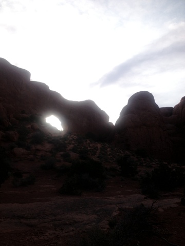
The Windows are a series of arches that are built into rock faces, creating the appearance of "windows" through the rock.  A 1 mile loop trail circles these rocks, mostly crossing open, arid terrain. We took the loop hike in a counter-clockwise direction, and were rewarded with a really cool view of the La Sal Mountains as we climbed the slick rock up and around to the other side of the formation.  

As we passed the windows from the back side, several visitors had managed to climb the the base of the arches.  The abundance of slick rock in Arches makes it possible to climb  just about anything, but getting back down can be much harder than it seems!

By the time we were finishing the loop, it looked like storm clouds were rising over the La Sal Mountains and opening up.  Sheets of rain could be seen draping down to the mountainsides like fingers of pale light.  Framed by the arch windows, it made for a pretty impressive scene.  Walking around the arches at twilight turned out to be a great choice, as the fading sunlight and colorful skies did some really neat things to the rocks.

Our last hike of the evening was the Park Avenue hike.  Early visitors to the park named this section for its resemblance to the tall buildings in New York.  The Park Avenue Trail is a 1 mile path through a small canyon between large fins of rock that resemble sky scrapers.  We left from the higher end, a dubious choice considering the up-hill we faced on the return trip!  The day's light was fast fading, so we only hiked about half of the trail before turning around and making the climb back up the the trail head.  Even the modest, 200 foot climb left us exhausted in the desert heat.

We drove out of Arches with limited daylight left, returning to our campsite for dinner.  Cooking in the dark had its challenges, but at least it was finally below 100 degrees outside!  It was a miserable night of sleep, as the heat never subsided much in our tent.  I was somewhat relieved when it was light out again and I could at least get out of the tent.  

We were back in Arches before 8 am, hoping to take advantage of the "cooler" weather in the early morning hours.  It was only 90 degrees in the park when we started hiking.
  
The Devil's Garden trail is the longest and most challenging hike in Arches National Park, a park not known for difficult hiking trails.  The hike is an out and back trail that visits a number of famous landmarks in this more remote corner of the park.  If hikers take the optional primitive trail back from the far end of the main trail, it becomes a difficult 7.4 mile loop.  We would decide that the main trail was difficult enough in the heat, and only do the 5 mile out and back along the main trail.

The first mile of the trail was a well-maintained pathway, with fences along the sides to keep hikers on the path and off of the fragile cryptobiotic soil of the surrounding landscape.  The path had a number of spur trails that lead to attractions along the way, including Navajo Arch, Landscape Arch, and Pine Tree Arch.  We stopped for pictures at each of these locations.  Much of the trail was delightfully shady during the morning.

Past Landscape Arch, a thin, spectacular arch that looked ready to fall, the trail suddenly became much more difficult.  A challenging, 100 foot climb up slick rock took us to a higher plateau.  Much of the next mile was spent rock hopping, scrambling up slick rock and walking along the spine of some of the "fins," or large narrow rock formations common in this terrain.  The views were amazing along much of this section of the hike.  I had the distinct feeling of walking along the top of the world.

The last major arch on the hike was Double O Arch.  Double O is a pair of arches that are nearly stacked on top of one another.  Some hikers had managed to climb on top of the arch, which seemed like a bad idea to me.  It was at least a hundred feet straight down, and the arch has to collapse someday!

Beyond Double O, the trail dropped gradually over sandstone ledges, reaching the desert floor.  The rest of the trail to Dark Angel was an easy walk on soft sand through desert scrubland.  Dark Angel is a spire jutting straight out of the desert. Over a hundred feet in heigh, this spire of rock has a shiny black color to it, possibly the inspiration for the name.

The return hike to the trailhead was a bit easier in most places, as it seemed to go more downhill than up.  A few of the scrambles down slick rock made for slow, careful going, however.  By the time we returned to the main pathway, it was almost noon, and the sun was quickly becoming oppressive.  Our packs were both drained of water by the time we reached the trailhead.  

We ate a picnic lunch in the Jeep with air conditioning running.  It was 109 degrees outside in the mid-day heat.  After eating, we headed for the Moab Aquatic Center, the perfect place to survive the hottest heat of the day.  For only $7, we got not only a shower (the first in a quite a few days), but also access to the indoor and outdoor pools, complete with water slide and crazy-high diving boards. 

We stayed at the pools for as long as we could stand to wait for dinner, avoiding the worst of the day's heat.  In the evening, we visited a couple of classic Moab destinations.  We had dinner at the Moab Brewery.  We had purchased a few of their brews at convenience stores across Utah during our trip, and were eager to check the place out.  They had a large selection of vegetarian food, which we enjoyed with a sampler of their microbrews.  Utah has peculiar and difficult to understand liquor laws.  One result is that their beers are all low percentage (below 4), which is very unusual for a microbrew.  That said, they are all very good, and in the desert heat I'm not sure we would want more!

After dinner we stopped at Milt's for milkshakes.  Milt's is Moab's oldest restaurant.  Located in a tiny building a block off of Main Street, they only have a couple of tables and a counter for seating, but fry up burgers, fries, and tater-tots, along with awesome milk shakes.  An oreo shake was the perfect way to wrap up a great day in Moab.  This quirky little town really is an oasis in the desert for outdoor enthusiasts. 

We have one more day in Moab, before we finally head for Colorado and mercifully cooler weather.  We've had a blast here, but are more than ready to escape the heat!


Saturday, June 29, 2013

Canyonlands Day 3: The Needles

We woke up early from the Cowboy Camp and quickly packed up.  We had a long drive ahead of us, and wanted to make sure we got to Squaw Flats Campground early enough to grab a first-come, first-served campsite.

We stopped off in Moab for gas and more ice for the cooler.  We had found that it took about two bags per day in the intense desert heat to keep drinks and produce cool.  By the time we were driving south towards the Needles District, temperatures were already pushing past 100 degrees.  

Driving to the Needles really gave us an idea of just how remote the place was.  Once we left Moab, we didn't see another gas station, or any other business, for that matter, for an hour and a half.  Traffic was heavy on the main highway, but after making the turn for the Needles entrance, we didn't see much in the way of people or cars, either.  

The road climbed high over a mountain pass, the surrounding hillsides lush and green.  Watching the temperature drop on the dashboard thermometer gave me hope for the conditions we would be camping in.  We were hoping to spend four nights in the Needles.  This would give us enough time to do some hiking through the unusual formations.

My hopes of cooler weather turned out to be merely wishful thinking.  The road rapidly descended to the floor of a canyon as we drove west.  The canyon walls were towering and steep on either side of the road, however the road was not completely enclosed in all directions, like in other parts of Utah we had driven through.  Dense stands of cottonwood trees lined the road to one side, an indication that there might be water somewhere nearby.  

We were relieved when we saw a sign for the "Needles Outpost," a store selling gas and other essentials right outside the entrance.  It wasn't until we visited the store later that we would find out just how remote this place was.  

We hurried into the campground to make sure we got a site.  It turned out this wasn't going to be a problem.  Most of the sites were empty.  We found one right next to the bathroom with a wonderful hidden amenity. 

A small trail at the back of our campsite lead through a dense stand of shrubs and small trees, and into a cave.  The cave was actually a slot canyon formed by the towering rock formations overhead.  The canyon was closed off on the other end, and only had a couple of gaps where the rocks came together above, so it functioned like a cave.  In this dark rock tunnel where the sun never penetrated, it was wonderfully cool.

This was an important discovery, because the air in the campground was around 107 degrees.  The sun bore down on everything with an intensity I had never felt before.  We were determined to set up camp right away, so we hauled out the tent and went to work.  The poles and stakes were painfully hot in only minutes of sun exposure.  Putting up the tent became a game of hot potato, and by the time we were done I was soaked in sweat.  

The terrifying heat seemed to threaten to cook everything and everyone in the desert at any minute.  We pulled out the camp chairs and retreated into the cave. The air was at least 30 degrees cooler in the shadowy cave.  We collapsed into our chairs and waited for our breathing to return to normal.  

Mary remembered the sign in the bathroom that warned of problem bears and ravens.  Apparently the ravens have learned to unzip things, and will tear apart a campsite with food in minutes!  With our campsite out of sight, we decided our only option was to haul all of our food into the cave with us for the time being.  

We wiled away the afternoon reading and snacking on our pile of food in the cool cave.  We had several visitors while we were in there.  First, a small ground squirrel scurried into the cave.  He sprawled out his legs, collapsing so his belly was directly on the soft, cool sand in the shade.  He appeared to be panting.  Our daring visitor made a few plays for our food, but I think he was mostly just after the cool shade.  

A little while later a jackrabbit hopped into the cave.  He dug himself a small trench in the sand and flopped down only a few feet from us, and the squirrel.  They were joined by a chipmunk later.  Mary had the idea of putting out a cup of water, which the chipmunk literally dove face-first into, lapping it up!  I had the distinct impression that this cave played a critical role in the survival of several the desert's inhabitants during the hottest hours of the day.

We had planned to go for an evening hike, but the weather just wouldn't cooperate.  At 7 PM it was still over 100 degrees outside.  We took a drive up to the Needles Outpost to look around instead.  The outpost looked to be more like someone's home with a few shelves of canned food and snacks and a couple of coolers of drinks.  Ice was $5 per bag.  Gas was $6.50 a gallon.  There went our idea of taking a drive on the four wheel drive roads!  We immediately resolved to make it back to Moab on the one tank of gas.  

When the sun finally dropped out of the sky, it was time to make some dinner.  The air remained oppressively heavy into the night hours, but the darkness brought out a new set of problems.  Hordes of flies, moths and other bugs came to life after dark.  They made cooking and doing chores around camp into a miserable ordeal.  We ended up eating our pot of chili while sitting in the Jeep with the air conditioning running.  At 9 pm, the dashboard thermometer read 98 degrees!

As we climbed into the tent, hoping we would be able to sleep in such tough conditions, we decided to abandon hiking in the Needles on this trip.  Perhaps in another year, and another season's weather, we will come back.  The area looked fascinating from the road, with a myriad of bizarre rock formations in every direction.  

We fell asleep that night to the occasional pattering of something bouncing off the rain fly of our tent - not rain, but hundreds of insects colliding with the tent in the darkness.  


Friday, June 28, 2013

Canyonlands Day Two

By 7 am the sun's light had crept over the small dome of slick rock behind our campsite, invading our comfortable sanctuary from the previous day's heat.  With the tent quickly becoming a green house, it was time for breakfast.  

After cooking breakfast in camp, we drove to the visitor center to fill up our daypacks with water.  The cowboy camp didn't have water, and the visitor center, about ten miles south, was the closest water source.  We decided to do a few short hikes in the morning while it was still a bearable temperature in the desert. 

For our first stop, we headed for the Mesa Arch Trailhead.  More of a short walk than a hike, the Mesa Arch Trail is a half-mile loop to a picturesque arch on the Island in the Sky Mesa.

The walk only took a few minutes, and the path was well-maintained by the park service.  The arch itself was more impressive than in the photos I had seen.  I was able to climb up to the edge of the rock running underneath the arch, and was surprised to see that there was a drop off of close to a thousand feet immediately beyond.  Photos taken from the right angle captured the vast landscape framed by the arch.   We hung out long enough to take a few photos.  A handful of other tourists climbed the rocks around the arch searching for the perfect photo.

With our warm-up hike out of the way, we drove further across the mesa towards the Aztec Butte Trailhead.  This hike was a more formidable 2 mile round trip jaunt to a couple of archeological sites.  Most of the trail was a level walk through open desert scrubland on a sandy path.  We spotted a young jackrabbit on the side of the trail, munching on a long stalk of grass.  He didn't look to be alarmed by us.

Part way along the path, a side trail branched over the base of a large rock formation.  From this point, we climbed 40 or 50 feet of slick rock to the top of the formation.  The trail crossed the flat, rocky top to the other side and then descended to a cave.  Inside of this cave were remnants of an old granary used by indigenous peoples long ago.  It looked as if they had made bricks out of the clay and stacked them inside of the cave to create a storage space.  

We followed the spur trail back to the junction, and then continued towards Aztec Butte.  The butte was a large dome of gray rock, with scattered sandstone rocks and ledges.  The top of it was perfectly flat, and lined with green vegetation.  The easy trail quickly turned hard from here, as we had to ascend several hundred feet of slick rock at steep angles.  This was the hike when I began to trust my footing on the slick rock, which isn't really slick at all when its dry.  

On the table-flat top of the butte, the trail made a loop around the perimeter, affording views in all directions of the Island in the Sky Mesa, and the towering canyons of the Green River.  Ruins from another primitive structure were to one side of the trail.

The trip down went quickly, aided by a few stretches of scooting on our bottoms to avoid falling down the steep rock.  We made the easy walk back to the Jeep and headed further down the road for another hike.

Our third hike of the morning was to Whale Rock, a large formation of slick rock that resembles a whale if viewed from the right angle.  The trail was only a mile round trip, but it made a steep climb over ledges of sandstone and slick rock to the large, flat area atop the formation.  We sprawled out on the rocks, soaking up the sun and taking in the panoramic views of the landscape around us.  

By the time we had made our way back to the Jeep it was almost noon, and the air was quickly becoming too hot for hiking.  We decided to drive into Moab and look for an air-conditioned place to hang out during the warmest part of the day.  We ended up grabbing lunch and cold drinks at Sweet Cravings, a cafe right in town.  They had air conditioning and didn't mind us loitering at the table for a few hours.

The car thermometer read 106 degrees as we drove out of Moab, but by the time we had made the drive back to the Island in the Sky, it was a respectable 95 degrees outside.  We refilled our day packs with water at the visitor center and headed for the Murphy Point Trailhead.  

 The Murphy Point Trail provided an easy 1.8 mile walk to the edge of the canyon.  The hiking was mostly on sand and occasional slick rock, and the elevation never gained or lost more than a hundred feet.  The trail passed through an open, arid terrain of cacti and juniper.  As we approached the canyon edge, we had to climb across a sizable gap between large chunks of slick rock.  I found it was easier to get a running start heading down one rock before leaping the gap and using the momentum to climb up the other side.  Mary preferred the slower approach of scooting down one side, getting a foot hold and hand hold and then scrambling up the other side.  I'm finding this slick rock to be a fun surface to hike on.  As long as it doesn't rain, and there isn't any loose sand or gravel on it, the surface provides predictable and consistent footing.

 The view from the canyon edge was surreal.  A  sheer drop-off of about 1,400 feet provided views of the white rim road ( a path for 4 wheel drive vehicles) far below, and of a maze of mesas and canyons stretching to the edge of the earth.  The waters of the Green River were visible from the overlook as well.  

We hung around at the overlook, eating some animal crackers and debating how many miles we could see.  Eventually, we made the hike back to the Jeep.  

We drove back to the campsite in time to watch the sunset.  The sun melted into the horizon, casting off an infinite number of shades of red and yellow.  We cooked dinner in the cool, twilight air while the skies took on a rich, violet color.  Bats darted about the campsite as darkness took over the desert.

After dinner, we sat up for a couple of hours, enjoying the awesome display of stars.  With so little light from cities visible, and the moon not coming up until after midnight, the night sky was spectacular.  The glowing, gaseous blanket of the Milky Way stretched from one horizon to the next.  Eventually, our fatigue overtook our appreciation of the night show, and we climbed into the tent for a quiet night of sleep.