Tuesday, July 3, 2012

Day 5

Last night some pretty big storms rolled through in the middle of the night. My sleeping position in the Story Spring Shelter had my head at the edge of the platform, with only inches of awning above me. A bright white flash of lightning cut through the sky at one point, waking most of us in the shelter up. Heavy rains followed, but fortunately the winds were not too severe, and we stayed dry under the covering.

By the time morning came we were greeted by clear, blue skies. The evening's rainstorms would continue to drip from the trees for a few hours, but the skies would stay dry all day for us. Our hike took us through some fairly level terrain for the first couple of hours. We crossed a couple of roads and a picturesque stream along the way. We stopped for a long break at Kelly Stand Road to prepare for our long climb.

The trail up to Mount Stratton was our first really big climb of the hike. The trail climbed over 1700 feet in about 3 miles, topping out at an elevation of a little below 4000 feet. The trail climbed at a moderate, but relentless clip. Gradually the forest changed over to all pine, and the air became cooler as we climbed. More than a few breaks were necessary along the way. I think we both probably could have rung the sweat out of our clothes by the time we were halfway up the mountain.

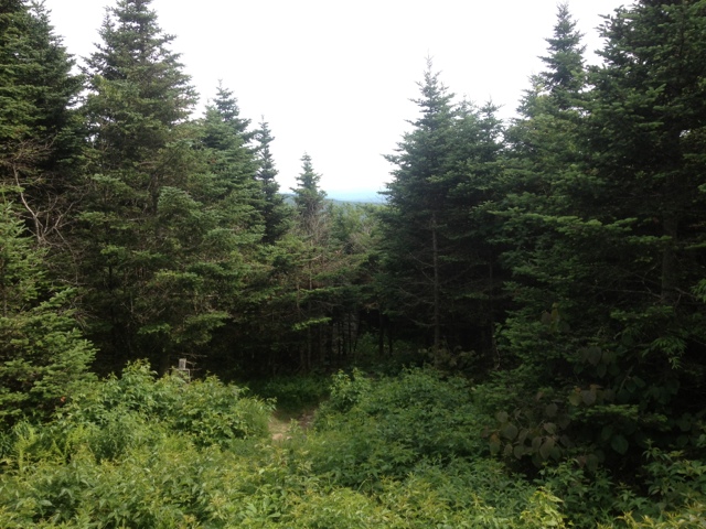
At just the point when I was beginning to wonder if I could possibly keep putting one foot in front of the other we broke out into a clearing. The summit was ringed by dense pine trees blocking the view, but there was another fire tower open to hikers. This tower was 55 feet tall. As I climbed the little wooden steps the winds began to howl. It was a real white knuckle experience, but the view was worth it! We could see Stratton Pond, our destination for the night, and mountains ringed us in all directions. The sky was a thick blanket of puffy, grey and white clouds, drifting quickly over the summit. It threatened of rain that would never materialize.

After snapping a few pictures with the battery life I had left on my phone and eating our nutella wraps (still delicious on day 5) we started the long descent down the mountain. The trail dropped quickly, but not so rapidly as to kill our knees, like the descent to route 9 did.

Around 3 we reached the Stratton Pond shelter. The shelter itself was situated a ways up the hill from the pond. This shelter looked fairly new and had wooden bunks on two levels with room for 16.

After setting up our camp stuff and filtering water we eagerly ran down to Stratton Pond for a swim. Other hikers said the water was cold. They had obviously never been to Lake Superior! We picked our way over the rocks on the shore until the water was deep enough to dive in. The water was cool and refreshing. It felt great to wash off some of the dirt and sweat from hiking 43.8 miles. Being away from water this long was hard for a couple of Michigan kids.

We spent the rest of the night cooking dinner and chatting with the group in the shelter. A group of section hikers from Pennsylvania shared their chocolate with us. They are planning a trip to Isle Royale National Park, so we were able to share our knowledge with them.

Our hike is going well so far. We have 229.2 miles left and tomorrow is a town day. We are already excited for a hot shower and warm food!

Day 4

Last night was a great one at Goddard shelter. The shelter was full of hikers with good stories. A cool breeze blew throughout the night and a bright moon cast a soothing light over the mountains and trees. This was the best night of sleep I have had on the trail so far.

In the morning we woke up a little before 7 am and were hiking by 8 am. After a quick 15 minute climb we were at the Summit of Glastenbury Mountain. At 3748 feet this was our highest point on the trip so far. The summit was covered in trees blocking the view. Fortunately, there was a fire tower open to climbing. The view from the top was fantastic. The mountains extended in all directions, covered in a gorgeous blue haze. Looking at the landscape from this perspective really gave me a concept of how rugged the terrain around us is. Through hiker Spock was at the summit allowing us to get a picture with both of us in it.

The rest of the day's hike was fairly easy. The trail alternated between modest climbing and descending. We stopped for lunch at Kid Gore Shelter, which had a great view of a mountain lake in the distance.

We reached the Story Spring Shelter in time to filter water and set our stuff in the shelter before a brief rainstorm broke out. The crowd at the shelter has been really fun. Spock from last night is here again, along with some section hikers headed to New Hampshire. There is also a through hiker that is a perfect doppelgänger for Jeff Bridge's role in the Big Lebowski. Fittingly, his trail name is The Dude. The dude was able to build a decent fire tonight which helped with the bugs.

Tomorrow we will hike to the summit of Stratton Mountain, our first big climb of the trip. We have hiked 33.3 miles of the LT so far and have 239.4 to go. Making progress!

Saturday, June 30, 2012

Day 3

Last night was a great night for sleeping. The day's heat faded quickly and a strong breeze made for a cool and refreshing night. We were both asleep before 9:30, something unheard of for us! We slept soundly until a bunny hopped into the side of our tent at full speed. We both sat up with a start as it hopped away more stunned than we were . Fortunately this was our only nighttime visitor.

We set the alarm for 6 am so we could get an early start on the trail. We listened to the trail stories of a section hiker from Alabama while enjoying our granola and coffee for breakfast. The sun was shining and a light breeze made the heat bearable as we began hiking a little before 8.

Today's hike was mostly easy. The trail climbed gradually over a couple of minor peaks before beginning the big push up Mt. Glastenbury. Several lookouts provided great views of the surrounding mountains for our breaks.

The climb up to the Goddard Shelter was hard, and coming at the end of the 8.5 mile stretch, was kind of a kick in the face. The trail climbed over big rock steps at a somewhat steep angle. Eventually we broke through the trees and reached the shelter.

Goddard Shelter is the nicest one we have been in so far. It was built in 2005 and has been very well maintained. In addition to a covered area for preparing food, it has a great view of the mountains in the distance. We decided to take advantage of the nice shelter and call it a day at 8.5 miles.

We've spent the afternoon relaxing in the shelter and chatting with an AT through hiker who used to work on Wall Street. So far, all of the people we've met out here have been really nice and really interesting.

Out hike is going slowly, but we should be in Manchester Center on Tuesday. 24.4 miles down and 248.3 to go!

Friday, June 29, 2012

Day 2

Shortly after writing yesterday's post I collapsed asleep and was largely unaware of the world for a few hours. We were awoken twice during the night. The first time occurred when something started banging around the shelter loudly. It was too dark to see what it was from the tent and I was too tired to go have a look. Whatever it was sounded like it was having a good time rifling through all of the hung packs. Eventually I was able to fall back asleep. Mary shook me awake at 5 am in a panic as it had started raining. We stumbled out of the tent and frantically put the rain fly on. By the time we were back in the tent it had already stopped raining. We managed another four hours of good sleep as we were both still exhausted from the long hike.

Upon finally starting our day we were relieved to find that our packs were still intact. Someone had chewed a hole in the food bag and absconded with our salted almonds during the night, however. This was a real blow as the almonds were our favorite treat.

We were moving slowly this morning and didn't step onto the trail until after 10 am. The first couple of miles were spent listening to our muscles and joints complain about the continuing abuse. Eventually we settled into hiking and the miles began to tick north. The forest was remarkably consistent. After a while it felt like we were hiking on a woodland treadmill. We reached the summit of Harmon Hill around noon and took a long snack break. The trees concealed the view from us but at least there was a pleasant breeze to keep us cool and the bugs at bay.

The hiking got much harder after our break. The trail dropped 900 feet in a little over a mile. Worse, it used a seemingly endless switchback of rock steps to descend. Our pace slowed to a crawl. By the time we reached Vermont 9 (the highway) our legs were shaking from the tiring descent. We took lunch at the road and spent some time talking ourselves out of going into nearby Bennington.

After lunch the trail climbed close to a thousand feet to the Melville Nauheim shelter. We began to encounter groups of weekend backpackers headed up the trail, their packs and clothes cleaner than ours. It came as a surprise to both of us that it was Friday. The work week is just beginning for us.

We decided to stay at the shelter for the night. We only managed 5.8 miles today. On the plus side we were able to relax in the hammock for a while. The skies are clear blue and there is a strong breeze blowing through the birch forest we are camped in. We'll probably get into Manchester Center a day later than planned but it was worth it to get some quality relaxing time. I'm looking forward to a good night's sleep and the long climb up to Goddard shelter tomorrow. In the meantime we'll get a chance to listen to the stories of the AT hikers staying here tonight. It's nice to be in the woods.

Thursday, June 28, 2012

Day 1

Today was one of the longest and hardest days of hiking I can recall. As I lay here in my tent writing I can feel my leg muscles aching from the day's hike. It may be quite the challenge to get them to work again in the morning!
The day started off with a quick, light breakfast at Dunkin Doughnuts before we returned the rental car. The young man working at Enterprise rental car gave us a ride back into Williamstown and the trail head. The car he drove us in had an unfortunate odor issue that made us eager to get on the trail. I could only assume that the car's previous driver had used it to transport garbage or large quantities of road kill.

We strapped on our packs and stepped off from the Pine Cobble Trailhead a few minutes after 9 am. The trail climbed gradually at first through a beech and maple forest alongside a subdivision of high end homes. I can imagine how glorious it would be to live in a house with a trail to Vermont in your backyard! After about an hour of steady climbing we reached the summit of Pine Cobble. At 1890 feet it wasn't much compared to what we have in front of us but it did provide a great view of Williamstown from above.

In another half hour of climbing we reached the intersection with the Appalachian trail. The trail crossed over large rocks bleached white by the sun. Some of the rocks were adorned with blueberry bushes, a tasty discovery.

A little before noon we reached the Vermont state line. We had hiked more than five miles and ascended over a thousand feet and we were now at mile 0. Yes, all of the hiking before the state boundary counts on my knees, feet and ankles, but none of it counts towards the 273 on the Long Trail.

After adjusting to this sobering reality, we trudged on. Around 2 pm we arrived at the Glen Ellis shelter. We were exhausted so we decided to take a long break for lunch before deciding if we should go any further. As tired as we were, I really wanted to knock out more of the trail while we had beautiful weather and fresh legs. A two hour break with lunch was enough for both of us to feel recharged. We decided to go for it and bit off another 7 miles of trail.

The trail climbed to a couple of summits with limited views along the way. We passed by some serene looking wet lands and the most elaborate beaver pond I have ever seen. The forest seemed constantly alive with bird song and squirrels busily chasing each other or chastising us. The long hike dragged on and the woods began to grow dark. Just when we thought we might be night hiking we reached the Congdon Shelter. We had hiked for the better part of 12 hours and traveled 14 miles.

Congdon shelter was a dump made less appealing by the fading twilight. In the few minutes it took Mary to set up the sleeping bag she watched enough mice scurry about to decide better of sleeping in the shelter. We decided to pitch our tent near the shelter for tonight. I filtered water from a pretty little Brooke and Mary prepared our dehydrated cheese enchiladas in the dark. Dinner tasted amazing after such a full day on the trail.

As I lay here in the tent finishing this I just heard a barred owl call out. The forest feels calm and welcoming and I am eager for sleep. 263 miles of hiking remains on front of us. Goodnight everyone.

Wednesday, June 27, 2012

Through-Hike Eve

Well, after spending the better part of 12 hours in the car today we are finally ready to start hiking. We were up at 7 am today. When I opened the door to the Willows Motel to put the rest of our stuff not going on our hike into the Jeep the sun was already climbing over the mountains. Bathed in warm sunlight, the Green Mountains looked friendly and inviting. We visited the organic bakery and grocery store next door for coffee and fantastic chocolate croissants. Next we drove to the post office to mail one of our food drops. The nice thing about mailing it out here is that the postal worker knew what we were doing because other people do this. Back home the exchange definitely would have brought a "your doing WHAT?". The postal worker was friendly and also a Georgetown basketball fan that likes Michigan State due to Magic Johnson. I think he was happy about the opportunity to talk sports for a change.

At 9 am we picked up the rental car and started our very long shuttle. Our path took us thru Bennington where we could visit Papa Pete's for a robust breakfast. In addition to being a great breakfast joint, this place is famous for being a frequent hang out for members of the band Phish. A healthy helping of French toast with real Vermont maple syrup provided fuel for our long drive.

We stopped at the Inn at the Long Trail to drop off another food drop for ourselves and continued north. The Quechee Gorge provided another rest stop a little while later. Below is a picture of the Gorge. After another three hours of driving we finally reached the small rural community of North Troy. We met the host of the B and B and parked the Jeep for its monthlong rest.

On the drive back to Williamstown we stopped for dinner at the Mainstreet Grill. The grill is a New England Culinary Institute restaurant, providing a training location for their students. This means you get gourmet quality food and service at below market prices. I had a cheese plate featuring all Vermont-made cheeses and a wonderful mushroom risotto. I'm sure I'll be thinking about this meal when I'm eating tomorrow night's dehydrated dinner!

As a write this we are finishing our drive back to Williamstown. Tomorrow our adventure will finally begin! We are both nervous and antsy to get hiking! Driving the entire length of Vermont today really helped to reinforce how completely crazy this hike is. That said, I'm really excited! I'll post every day that I have cell service on the trail. Wish us luck!

Tuesday, June 26, 2012

The Eastward Trek

The alarm went off at 5 am and after a couple of necessary snoozes we were on the road. We made a quick stop at Big Apple Bagel for coffee and bagels and started the long trek east. Going out east is a much different experience than the usual trip up north. Going up north in Michigan involves passing through mostly undeveloped woodlands dotted with small communities like Grayling, Gaylord and Mackinaw City. Driving east entails passing through endless suburban sprawl marred only by delightful cities such as Flint, Port Huron, Sarnia and Hamilton. On these marathon days I reach a point at which I begin to think "why on earth are we doing this? I think we might pass away in the car!". All of the exits have the same five businesses and the local radio stations all play the same Katy Perry song with maddening regularity

The border crossing can also be a real treat. I have nothing but respect for the men and women who guard our borders and keep us safe. I'm sure it is an impossibly difficult job. After many hours in the car, however it can be tiresome to discuss the origin of the contraband carrots in my cooler. You know, the ones I bought at Kroger in Holt. At today's crossing south of Niagara Falls, NY we had just slowed to a stop at the border crossing when I decided to open my door for a second to stretch my legs. A gust of wind caught hold of the pile of papers I had on my lap and scattered them into the road. I was forced to sprawl onto the pavement and use my arms and legs to knock down and secure the wayward papers, all the while wondering if I had caught the eye of a customs officer deciding which car to search. At times like these Mary likes to break into song. You never know when a nice rendition of Lee Greenwood could come in handy. Fortunately, the customs officer only asked us a couple of questions and we were back on the road again.

Passing into New York things started to improve. Roadside service plazas offered Starbucks frequently enough to keep us dangerously caffeinated. After we made a lunch stop in Rochester the thru-way began to pass through some National Wildlife Refuges. A bald eagle flew directly over the Jeep at one point. The flat terrain of Ontario slowly evolved into hills that grew larger as we drove.


As we entered Massachusetts the Berkshire Mountains began to dominate the landscape. The mountains were veiled in wispy patches of fog drifting across the dark green masses of land. The skies had grown gray and occasional rain showers began as we drove into Williamstown. This area is still one of mystery to us. It gets dark much earlier in the east, which definitely adds to the sense of the unknown. We checked into our hotel and found some dinner at a great tapas place. Tomorrow we pick up the rental car and shuttle the Jeep to the north end of the trail. We made the last few painful decisions of what to take and what to leave in the Jeep before bed. I'm doubting we'll sleep very well tonight as we're both pretty hyped up to begin our hike. Here is the view entering Massachusetts: