The longest day of the year, in terms of daylight, is approaching in the next 10 days. We decided to make the most of this one by setting our alarm for 5 am.
Van Riper State Park turned out to be Grand Central for campers last night. In addition to the throngs of tourists and locals enjoying the warm weather, it was "paws in the park day." The average campground had two wet, smelly and happy pooches. This made for an entertaining evening as it only takes one barking dog to start a concert. This did make me miss my cats, although camping would most definitely not be their thing!
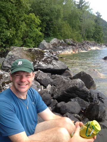
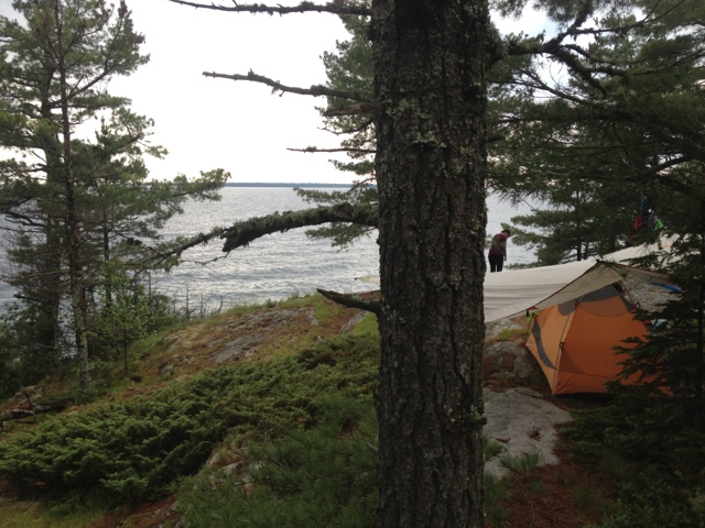
The park is situated right on the shores of beautiful Lake Michigamme. We took advantage of the warm weather and went for a swim at sunset before enjoying a fire and the first s'mores of the season. It was a magical night in the forest, with mild temps and a blanket of stars. It was a quiet night, not the creepy too quiet kind, but just right. I slept like a rock, awakening to that 5 am alarm a bit too soon for my taste.
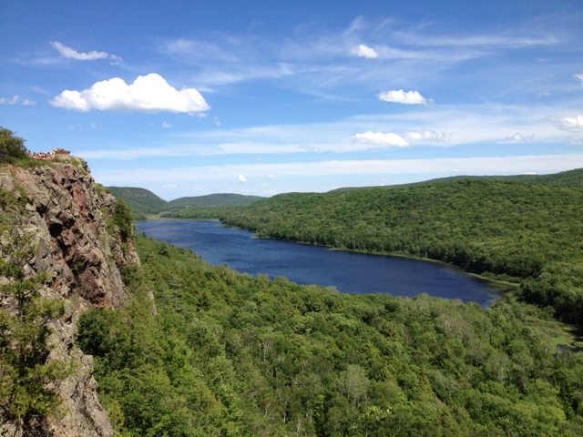
We threw the camp gear in the Jeep and headed for nearby Craig Lake Stare Park. Craig Lake is Michigan's most remote park (other than the island park Isle Royale). It is reached by driving 9 miles on a rough gravel road weaving through a network of swamps, bogs and woods . The entrance bears a warning sign about the road conditions, but the recent dry weather made for little difficulty this morning. We parked at the trailhead and took the day's first cup of coffee for a walk down to the shores of Craig Lake. The waters were perfectly calm, reflecting the trees and blue skies in a perfect mirror image. Craig Lake is home to a large heard of Michigan's moose population. We walked quietly along the shores hoping to spot one of the giant creatures. Moose can be elusive and we would have to settle for a beautiful sunrise.
Our marathon day continued with the drive into Marquette for breakfast at The Sweetwater Cafe. This was our first trip to this place that specializes in multicultural, organic food prepared with local ingredients . The Huevos Rancheros was some of the best I have ever had, served with black beans, rice and homemade salsa. After an extra cup of coffee we were back on the road. This time we headed north to the town of Big Bay and a rustic hike to a famous series of waterfalls. The Yellow Dog River runs through the Ottawa National Forest and the McCormick National Wilderness, named for the family that donated the land to the government for recreational use by all. The trail head lies twenty miles west of Big Bay and is only reached after navigating a maze of dirt roads and two-tracks. Driving to a remote trail in the woods is often a nerve racking experience, and this time certainly was. The "roads" were unmarked, meaning we had to use the compass and trip odometer to figure out which intersection we were at and the correct way to turn. The farther we drove the more remote it got and the louder the voice sounded in the back of mind telling me to turn around. It is impossible at moments like these not to play-out the worse case scenario game. "What if we get lost?". "What if the Jeep breaks down?". "What if the folks we just drove by in that militia style compound are in fact armed to the teeth and harbor a deep-seated resentment of city folk in red Jeeps?". Fortunately, none of these played out and after a 45 minute bumpy drive, we found ourselves at an abandoned trail head in the middle of an old growth forest. It was a four mile hike round trip out to the Yellow Dog River. Once we reached the river we picked our way along a faint trail that reinforced the remoteness of this area. Staying on the trail required climbing under and over downed trees, rock hopping through quick-sand like mud and eventually shimmying across the river on a well-placed downed tree. The reward was a fantastic view of the 15 foot cascade that few people ever get to see. After enjoying the view for as long as the black flies would allow, we made the return hike to the Jeep. The car thermometer read 95 and we were both hot, sweaty and buggy from our hike. It was the perfect time for a swim. We drove back to Big Bay, paid the two dollar visitor fee at the Marquette County Park and jumped into the refreshing waters of Independence Lake. There is nothing better than swimming in cold clear water on a hot day.
Now we are on our way to Pictured Rocks National Lakeshore and Twelvemile Campground. Thanks to our early start, we still have close to 5 hours of daylight left! Here are some pictures:
.